Drascombe
Association
Viking Cruise 2014

In January 2014,
the opportunity arose to “sign up” for a three week Rally from Roskilde in
Denmark to Oslo in Norway. The planned route would take participants along the
Swedish coast through waters interspersed by hundreds of small and sparsely
populated islands. With a planned route length of 330miles (from Google Earth)
this would be our most ambitious Rally to date. Having bought Tra Bhui last
year to allow us to take part in longer and more challenging journeys, the
planned Rally would be an ideal opportunity sail in new and exciting waters and
to clock up some good sea miles at the same time.
Planning
Having put our
names down as participants we had a number of logistical and practical issues
to overcome.
·
The Rally dates did not fit in
with my work rota which required a bit of rescheduling of my time in
Kazakhstan. Luckily with my back to back who I have known for a good number of
years was happy to swap some weeks, allowing me the 5 weeks off that I would need
to get Tra Bhui to Denmark and take part in the Rally, although it did not
allow sufficient time to tow her home again
·
Kathleen could not commit three
weeks of her annual leave to the rally, but she was able to overcome this in
part by taking a week’s unpaid leave, and by flying out to Copenhagen to join
me rather than spend valuable time accompanying me on the drive to Roskilde.

·
My winter refurbishment of Tra
Bhui needed to be completed in time for the Rally – given that I work overseas
and my time in the UK is limited, any work on the boat has to be fitted in
around numerous other things and family commitments when I am home. Thanks to
my understanding family who let me disappear to my workshop at the bottom of
the garden whenever time allows and also for collecting the numerous packages
that arrive when I am not at home – mail order shopping certainly has its
place!
During January
ferry and flight bookings were made. The plan was simple enough, I would trail
Tra Bhui out to Roskilde in Denmark via the Newcastle / Amsterdam ferry. Kathleen
would fly out and meet me in Copenhagen. We would launch Tra Bhui in Roskilde
before driving to Oslo with the trailer. Once in Oslo we would leave the car
and trailer in Asker. Kathleen and I would then fly back to Copenhagen and take
the local train back to Roskilde where Tra Bhui would be waiting for us loaded
and ready to go. After sailing to Oslo we would put Tra Bhui back on her
trailer before flying back home via Edinburgh. I would then collect the car and
trailer 6 weeks later after my next work rotation.
Preparations
Although we have
both sailed out with the UK before this would be the first time that we had
taken our own boat abroad. After a bit of internet research we pulled together
a pretty comprehensive list of what we needed to take with us to be compliant
with the Scandinavian / European regulations. The list included paperwork and
equipment – see Appendix No 1. Whether in practice we would
ever have to produce these documents is a matter of debate, but we felt that we
should make the effort and have everything just in case.
One of the main
items to source was suitable charts which would cover Denmark, Sweden and
Norway. Having sourced and purchased charts for Denmark and Sweden on line I
decided to hold back on spending another
seventy pounds on Norwegian charts until the final route was determined
and I saw what coverage the Swedish charts actually gave us. This turned out to
be a false saving as we needed the charts for Norway and having reviewed the
Swedish charts in the UK prior to leaving, I should have just ordered the
Norwegian ones online. Instead I decided that I would source them in Denmark or
Sweden where I thought they would be easily obtainable and potentially cheaper.
Wrong on both accounts , but more of that later.
The ongoing
refurbishment of Tra Bhui is covered in separate blog posts so I will not go
into detail here other than to mention that in addition to the numerous small
projects that were being undertaken simultaneously, there were a number of
bigger projects that were critical to going on the rally. These included, the
finishing and fitting of a bespoke camping tent, the installation of roller
furling / reefing for the new jib / genoa, the installation of electrics –
fixed VHF radio, navigation lights and especially for the Viking Cruise - a
chart plotter.
The chart
plotter was a late addition as previously I had been using an IPad with
Navionics software. While this had proven to be a great system, I had found
that when sailing between the Canary Islands and Africa in January that the IPad
kept loosing parts of the track. Having no idea why (it may have been a lack of
memory), I convinced myself that a chart plotter would be a good investment and
I took both the reduced prices being offered on the recently superseded Garmin
451 and the opportunity to buy the Garmin Blue Ocean charts for all of Scandinavia
for sixty five pounds on EBay as signs that I should take the plunge and
actually buy one. During the course of the Rally the chart plotter proved
invaluable and certainly worth purchasing!
Pre Rally testing.
I arrived back
in the UK just under a week before I would have to set out for Denmark. As Tra
Bhui was still an ongoing project and some of the major bits of new kit had not
yet been fitted, we decided to attend the first weekend of the Planned West
Coast Rally in Scotland to make sure that everything worked OK.
The Rally went
well – See West Coast Rally Blog entry - but we had a few modifications to make
before setting off for Denmark. These modifications were in the whole pretty
minor and included, grinding out the rudder bushes further, scarphing another
24” onto the mizzen mast to allow the boom to clear the outboards and to
provide a fixing point for our newly acquired red ensign, modifying the front
section of the cargo deck and a few other small items. With all things relating
to boat maintenance they were time consuming and all too soon it was time to
load up and set off for Denmark.
The Rally
10 Boats and crews
took part in the rally, travelling from Scotland, England and Ireland and the
Netherlands by various different routes and over differing timescales to meet
in Roskilde on the 2nd of May
Jim Hopwood Gig (with
cabin) Hippo England
Douglas Hopwood Drifter 22 Appuski Too England
Ian Cowie Coaster Moksha England
Jack O’Keeffe +
crew Coaster Tyboat Ireland
Simon Farley +
Ian Gibson Drifter Damson England
Ourselves Gig Tra
Bhui Scotland
Peter Kiers Coaster Batyr Netherlands
Michel Maartens Drifter 22 Dulcibella Netherlands
Roel Elveld Coaster Golfbreker Netherlands
Els and Fred
Roos Coaster Windroos Netherlands
Wednesday 28th May
Glasgow to
Newcastle – overnight ferry to Amsterdam


 Rising early I
managed to have breakfast before many of the passengers were up and about.
Outside the North Sea looked grey and forbidding. Low clouds hung over the
horizon and rain was never far away. As the approaching coastline drew nearer I
made my way out onto the passenger decks and after finding some shelter from
the rain I watched as we entered the port of Amsterdam.
Rising early I
managed to have breakfast before many of the passengers were up and about.
Outside the North Sea looked grey and forbidding. Low clouds hung over the
horizon and rain was never far away. As the approaching coastline drew nearer I
made my way out onto the passenger decks and after finding some shelter from
the rain I watched as we entered the port of Amsterdam.
Thursday 29th May
Amsterdam to
Roskilde


My accommodation for the night was to be a room at the Dan Hostel, which is a fairly new building right on the waterfront at Roskilde. Unfortunately the reception was shut and it was only after finally finding a telephone number for their out of ours service that I located the keys to my room in a nearby letter box.
Friday 30th May
Roskilde
 After a great
buffet breakfast at the hostel, I set off to find the Harbor Master to see
about leaving Tra Bhui in the car park for the morning as I had to drive to the
airport to pick up Kathleen and I did not see a 9m long trailer as an asset
when trying to find airport parking.
After a great
buffet breakfast at the hostel, I set off to find the Harbor Master to see
about leaving Tra Bhui in the car park for the morning as I had to drive to the
airport to pick up Kathleen and I did not see a 9m long trailer as an asset
when trying to find airport parking. The Harbor Master it transpired kept fairly odd hours and was normally to be found in his office on Tuesdays and Thursdays between given hours. As this was Friday I was advised by a helpful local that he was likely to be around the harbor somewhere and I should just look for him. Not knowing who I was looking for and after approaching a number of innocent boat owners (none of whom was or knew the Harbor Master), I simply left Tra Bhui in the car park and headed to the airport.
 Kathleen’s
flight was on time and soon we were heading back to Roskilde to seek the
elusive Harbor Master and sort out launching and a berth for the next few
nights.
Kathleen’s
flight was on time and soon we were heading back to Roskilde to seek the
elusive Harbor Master and sort out launching and a berth for the next few
nights.
Eventually we
tracked the Harbour Master down and were given a key card for the slipway
barrier and told where to berth Tra Bhui once launched. As Kathleen does not
really do the packing / unpacking bit she headed off to explore Roskilde while
I set to rig Tra Bhui and to transfer the pile of gear in the back of the car
to her.
Roskilde is an ancient city situated on the Danish island
of Zealand. Dating
from the Viking Age
and is a member of the Most Ancient European Towns Network.
According to
local history, in the 980s, Harald Bluetooth built a church
and a royal estate in Roskilde. Harald was buried at a church which is on the
same site as today's Roskilde Cathedral.
Roskilde was
given the status of a market town in 1268. It was probably the largest and most
important town in Denmark at the time. With the support of the Roman Catholic Church, it continued to thrive until
1443. But as a result of the Reformation
and the closure of the Roman Catholic Church in Denmark it lost its earlier
status. Roskilde Cathedral did, however, continue to be the place where the
kings and queens of Denmark were buried.

The city's
early importance is evident from the fact that the Roskilde Cathedral was the only cathedral in Zealand
until the 20th century. Built in the 12th and 13th centuries, it was the first Gothic
cathedral to be built of brick and its construction encouraged the spread of
this style throughout northern Europe. The cathedral is the burial site for
Danish monarchs and is a major tourist attraction
with more than 125,000 visitors annually. Since 1995, the cathedral has been
listed as a UNESCO World Heritage Site..
Another
attraction in the city is the Viking Ship Museum located alongside Roskilde Fjord. The centerpieces of its collection
are the well-preserved remains of five Viking ships, excavated
from nearby Roskilde Fjord in the late
1960s. The ships were scuttled there in the 11th century to block a navigation
channel, thus protecting the city, then the Danish capital, from seaborne
assault. The museum also undertakes research in experimental archaeology centered on Viking shipbuilding and
seaworthiness. These five ships represent several distinct classes of Viking
Ships, such as the Longship, and Warship, and smaller fishing and ferry boats.
 While Kathleen
explored I did the hard work and soon Tra Bhui was rigged and loaded with
everything we would need for the next 3 weeks.
While Kathleen
explored I did the hard work and soon Tra Bhui was rigged and loaded with
everything we would need for the next 3 weeks.
On Kathleen’s
return it was time to launch and so we slowly trailed Tra Bhui through the
public area to the slipway where a large number of visitors were sitting on
benches and gorging themselves on very large gross ice-creams.
As we were
obviously about to provide some local entertainment passersby stopped to watch
and soon we had quite a large crowd as onlookers. The launch went without a
hitch and Tra Bhui was soon floating alongside an adjacent finger jetty where unfortunately
our troubles started when the rudder would not drop into place. This was a
repeat of the problem we had encountered at Salen the previous weekend. Having
reground the bottom rudder mount after the West Coast Rally and before leaving
for Denmark, I had thought that this problem had been cured – obviously not!
The only cure was
to pull Tra Bhui out again. Luckily the crowd had not fully dispersed and they
quickly regrouped to watch the second half of the entertainment we were
providing. Winching the Gig onto it’s trailer when empty is hard enough.
Winching it on to it’s trailer when fully loaded is a herculean task. Luckily
the recovery eye and the winch were up to the job and Tra Bhui was soon back on
her trailer at the top of the slipway.
On investigating
the problem I realised that further machining of the bottom bearing would be
required and that given the limited selection of tools that I had brought with
us the simplest answer would be to just remove the bearing altogether. While
this would induce a degree of play in the rudder it would not affect its
overall performance. As removing the bearing would leave four holes through the
hull we trailed the boat back to the parking area and we set off to find some
cataloy / body filler. By this time it was early evening and everywhere was
shut. Local garages stock many things but few of them are car related and after
2 hrs. fruitless searching we returned empty handed. All was not lost however
as I had in my toolbox a tube of epoxy putty which I applied and left to cure
overnight.
With nothing left
to do we headed into Roskilde to find somewhere to eat. After perusing a number
of menus displayed outside establishments serving food, we decided that there were three distinct categories
of restaurant in Denmark, ones
(numerous) that we simply could not afford without selling body parts, ones
(few) which we simply did not fancy and ones (a few but harder to find) that looked good and which were affordable.
When it comes to
finding good places to eat, Kathleen comes into her element and we were soon in
a fairly traditional restaurant which had a limited but well priced menu of
local dishes.
Saturday 31st May
Roskilde to
Oslo
Rising early we
had Tra Bhui in the water by 7am only to find that the outboard would not
start! (It turned out to be dirt in the fuel and after I had dismantled the
carburetor and cleaned the bowl and jets the engine ran fine) Undeterred; with
Kathleen navigating I unshipped the oars and we headed off to out allocated
mooring spot. With Bhui safety tied up we returned to the Dan Hostel for
breakfast and to check. We dumped the last of our gear on board before heading
northwards towards Norway and Oslo where we would leave the car and trailer
until the end of the cruise.
 The drive to
Oslo was yet again uneventful. The roads were quiet and with a dual carriage
way / motorway for virtually the full journey, progress was good. Needing
diesel and lunch we stopped at off road services in Sweden. Having a mental
aberration Kathleen bought us a chicken tikka calzone pizza from the garage for
lunch – fore someone who does not normally choose pizzas, never chooses a
calzone pizza and does not like curry why she chose it is hard to understand.
It was rank and most of it went into the nearby bin where even the crows had
second thoughts before they attacked it!
The drive to
Oslo was yet again uneventful. The roads were quiet and with a dual carriage
way / motorway for virtually the full journey, progress was good. Needing
diesel and lunch we stopped at off road services in Sweden. Having a mental
aberration Kathleen bought us a chicken tikka calzone pizza from the garage for
lunch – fore someone who does not normally choose pizzas, never chooses a
calzone pizza and does not like curry why she chose it is hard to understand.
It was rank and most of it went into the nearby bin where even the crows had
second thoughts before they attacked it!
Onwards to
Norway and Oslo where our Tom Tom satnav decided that the quickest way to the
western side of Oslo was via the city center. Only after finding ourselves in
the traffic diversions associated with the city center improvements did I
realize that this was not where we wanted to be, especially when the road we
were following was closed. A hasty “U” turn was required outside the splendid
Oslo Opera house as we switched the Tom Tom off and followed the local signage instead.
Arriving in
Asker around 6pm we easily found Tim’s house where after we had parked the car
and trailer we accepted his generous invitation to join his family for a BBQ’d
dinner.
Sunday 1st June
Oslo
Having spent the
night in the “Comfort” hotel which was a good find right in the center of Oslo
and having eaten our fill at the inclusive buffet breakfast we set off to
explore the city on foot.
Oslo is believed to have been founded
around 1000 AD, and established as a "kaupstad" or trading place in
1048 by King Harald III, the city was elevated to a bishopric in 1070 and a capital under Haakon V around 1300. Personal unions with Denmark from 1397 to 1523 and again from 1536 to 1814 and with Sweden from 1814 to 1905 reduced its influence. After being
destroyed by a fire in 1624, the city was moved closer to Akershus Castle during the reign of King Christian IV and renamed Christiania in his honor. It was established as a municipality on 1 January 1838. Following a
spelling reform, it was known as Kristiania
from 1877 to 1925, when its original Norwegian name was restored.
Oslo is the economic
and governmental center of Norway. The city is also a
hub of Norwegian trade, banking, industry and shipping. It is an important center
for maritime industries and maritime trade in Europe. The city is home to many
companies within the maritime sector, some of which are among the world's
largest shipping companies, shipbrokers and maritime insurance brokers. Oslo is
a pilot city of the Council of Europe
and the European Commission intercultural cities programme.


 We spent the morning following the waterfront westwards. Ships of all shapes
and sizes filled the berths, including- the Norwegian Navy which was holding an
open day on a number of vessels, a mega cruise line which had all the grace and
beauty of an apartment block on the water, some historic and beautifully
preserved vessels belonging to a preservation society (a minesweeper, a tug and
an coastal steamer), numerous tall ships dating back over 100 years and which
are now used to carry tourists and numerous ferries servicing the fjord.
We spent the morning following the waterfront westwards. Ships of all shapes
and sizes filled the berths, including- the Norwegian Navy which was holding an
open day on a number of vessels, a mega cruise line which had all the grace and
beauty of an apartment block on the water, some historic and beautifully
preserved vessels belonging to a preservation society (a minesweeper, a tug and
an coastal steamer), numerous tall ships dating back over 100 years and which
are now used to carry tourists and numerous ferries servicing the fjord.We ate an early dinner at a waterfront bar as we watched the activity in the harbour before we walked back to the Opera House for a coffee

Monday 2nd June
 Oslo to
Copenhagen
Oslo to
Copenhagen
Up early we took the train to the airport and flew
Norwegian Airlines to Copenhagen. Our plan was to spend the rest of the day
having a look around Copenhagen before taking the train back out to Roskilde.
From Copenhagen’s airport there is a good train service straight into the city
center. Knowing little about Copenhagen we set off towards the waterfront as
our free issue tourist map suggested that this was the best area to walk
around.
Copenhagen is the capital
and most populated city of Denmark, with a population of one and a
quarter million people and a metropolitan population of
circa 2 million people It is situated on the eastern coast of Zealand, The city
stretches across parts of the island of Amager and also contains the enclave of Frederiksberg, a municipality in its own right.


Originally a Viking fishing village founded in the 10th century, Copenhagen became the capital of Denmark in the early 15th century. During the 17th century, under the reign of Christian IV, it developed into an important regional center, consolidating its position as capital of Denmark and Norway with its institutions, defenses and armed forces. After suffering from the effects of plague and fire in the 18th century, the city underwent a period of redevelopment which included the prestigious district of Frederiksstaden and cultural institutions such as the Royal Theatre and the Royal Academy of Fine Arts. After further disasters in the early 19th century when Nelson attacked the Danish fleet and bombarded the city, rebuilding during the Danish Golden Age brought a Neoclassical look to Copenhagen's architecture.

After walking around and through a number of parks and along old streets we
came to the waterfront area which I recognised from a previous visit which I had
made with work a few years ago. We ate lunch at a quay side restaurant, before following
the waterside around to the “Little Mermaid”. The Little Mermaid is certainly
not very big and is perched on a rock a few meters from shore. It is an obvious
tourists attraction and when we were there it was inundated with tourists,
although we were fortunate enough to get her top ourselves albeit only for a
matter of seconds between tour groups.

We headed back to the station via Copenhagen’s Castle where I was given a row by a Danish soldier for sitting on the grass. As the castle had only a few hundred acres of grass the jobs worth soldier was obviously doing his bit to promote tourism as well as protecting the environment.
We caught the evening train back to Roskilde where we found Tra Bhui had
behaved herself during our absence. We ate at the same restaurant that we had
eaten at on the Previous Friday evening before spending our last night at the
Dan Hostel.
Tuesday 3rd June
Roskilde
 During the
course of the day all of the boats arrived in Roskilde (some having arrived
late on Monday). Introductions were made as each boat was made ready and
launched. The harbor master with a change of heart allocated the new arrivals
berths close by the toilets and facilities while we remained in isolation
in the outer harbour.
During the
course of the day all of the boats arrived in Roskilde (some having arrived
late on Monday). Introductions were made as each boat was made ready and
launched. The harbor master with a change of heart allocated the new arrivals
berths close by the toilets and facilities while we remained in isolation
in the outer harbour. 

In the evening
we were joined by Simon and Ian from Damson, Els and Fred from Windroos,
Douglas from Appuski Too and Ian from Moksha for dinner in Roskilde. We ate yet
again at the same local restaurant, before returning to the harbor to sleep
onboard Tra Bhui.

Wednesday 4th June
Roskilde to
Kuluse
Wind East South East
Force 2 – 3 in the
morning rising to 4-5
in the
afternoon
|
Dry – some sunny periods
|
Temperature 17 degrees C
|
The plan as
discussed at the briefing was for everyone to set off at 10.00hrs and sail loosely
together down the fjord. Tyboat was first away just after 8.00hrs and by
10.00hrs we found ourselves the only boat still tied up at the pontoons – so
much for that plan! Rather than rush
ourselves (we had been preparing to leave for nearly 5 days we cast off at
10.45 by which time all the other boats were out of sight.
With the wind
generally behind us we had a very pleasant sail down the fjord with Kathleen
helming, until we reached the narrows where we swapped roles to have lunch.
Lunch on Tra Bhui is a fairly basic affair and consists of sandwiches and
coffee on the move. On special occasions (most days) we or I have a piece of
fruit cake as well. Approaching the narrows we could see the other tan sails
ahead of us albeit still at a distance.
The fjord is
spanned at Frederikssund by a road bridge which had set opening times. The
flotilla arrived at the bridge during
somewhere between 2 and 3 hrs. before it was due to open again and we
caught up with the rest of the boats as they lay at anchor waiting for the
bridge opening.

30 mins before
the bridge opening we hauled up our anchor and set our sails to make sure we
were ready to pass through when the time came. At 17.30 hrs. The bridge duly
opened and we began to follow the other boats through, giving adequate sea room
to boats coming through from the other direction. As we approached the bridge,
one of the raised arms began to lower, but as the other one was still up and we
were virtually at the bridge we saw no problem passing through, until when we
were at the bridge the other one began to descend. The rate of descent meant
that it would be touch and go whether we made it through or not so we decided
to go about while we still could, amazed that the bridge operator was intending
to happily drop the raised arm on top of us. Appuski Too which was just behind
us also had to go about.
 The actions of
the bridge operator meant we had to spend the next hour tacking back and
forward while we waited for the next opening. At 6.30 we were on the ball and
we passed through the bridge as soon as it was open to find that the Dutch boats
had kindly waited on the other side for us, while Tyboat and Damson had gone
ahead to find the harbour which we were planning to spending the night in.
The actions of
the bridge operator meant we had to spend the next hour tacking back and
forward while we waited for the next opening. At 6.30 we were on the ball and
we passed through the bridge as soon as it was open to find that the Dutch boats
had kindly waited on the other side for us, while Tyboat and Damson had gone
ahead to find the harbour which we were planning to spending the night in.
With the bridge
behind us we had a straight run to Kuluse staying well within the marked
channel as the water on either side was too shallow – even for a Drascombe! We
found this out when our center board bounced along the bottom virtually feet
from a channel marker.
 As the evening
fell we dropped our sails
As the evening
fell we dropped our sailsThe Scandinavian’s favour a system of mooring consisting of either bows to or stern to with the offshore mooring lines attached to wooden piles spaced at 3m intervals 15m or 20m off the jetty but parallel to it. Once you get the hang of this and you have your lines prepared beforehand it is a pretty good system. Needless to say we were not as prepared as we should have been, but thanks to the crews of Tyboat and Damson (“Harbour Master Ian”) who took our shore lines we made ourselves fast without too much collateral damage.

 With the rudder
in front of the outboard we need to be underway to allow the rudder to function
effectively if the outboard is being used– the quicker the better. While this
is not a problem for our normal sailing, due to the “prop wash” Tra Bhui simply
will not turn to Port while going forward or Starboard going in reverse when we
use the outboard. Therefor Tra Bhui has the handling characteristics of a small
supertanker. This is exacerbated when maneuvering as we have no speed and
therefore as water is not flowing over the rudder the outboard keeps us on a
straight line no matter which way we are trying to turn.
With the rudder
in front of the outboard we need to be underway to allow the rudder to function
effectively if the outboard is being used– the quicker the better. While this
is not a problem for our normal sailing, due to the “prop wash” Tra Bhui simply
will not turn to Port while going forward or Starboard going in reverse when we
use the outboard. Therefor Tra Bhui has the handling characteristics of a small
supertanker. This is exacerbated when maneuvering as we have no speed and
therefore as water is not flowing over the rudder the outboard keeps us on a
straight line no matter which way we are trying to turn.
I am sure we
cannot have impressed those on the jetty waiting for our lines as we carried
out a thirty point turn to get us pointing somewhere near the berth we were
aiming at.
Meanwhile out in
the fjord Drascombes were spread about
as the Dutch boats had decided to investigate a marina on the east side of the fjord
and having then decided not to stay there were making their way to Kuluse in
fading light.
To add a bit of
drama to the evening, Appuski Too had managed to become well and truly grounded
having decided to take a short cut outside the marked channel and venturing
into territory normally reserved for vehicles with wheels. Luckily with the Dutch
boats bringing up the rear help was at hand and eventually all the boats were safety
berthed in Kuluse.
Miles Sailed = 18
|
Miles Motored = 0
|
Total Miles = 18
|
Thursday 5th June
Kulhuse to
Gillelje
Wind East / South East
Force 4-5 gusting Force 6 |
Started dry – heavy rain
as approaching Gillelji |
Temperature 16 degrees C
|
Today’s sail
would take us to the north east corner of the Danish Island of Zealand (see appendix 2) allowing us to cross
the Oresund (stretch of water between Denmark and Sweden) the following day.
The passage was lengthened by the shallow waters that extended a good distance
off the mouth of the Roskilde Fjord but which were well marked by numerous
buoys.
On leaving the
harbor we raised our sails only to have the yard arm jump off its fitting onto
the mast. This left the yardarm on the deck and the metal ring to which the
main halyard is attached left at the top of the mast, well out of reach of our
boat hook. With a reasonable distance to cover during the day we set off under
jib, mizzen and outboard while we waited for the ring to gradually work its way
back down the mast assisted by the motion of the boat and gravity.
Soon we were
able to retrieve it and without mainsail up we were soon making up ground on
the rest of the flotilla.
 Sailing parallel
to the coast we had the wind on our beam for most of the voyage. With all our
sails up we made excellent progress even with the strong gusts which meant
heading upwind and / or letting out the mainsail. As we reached the small
headland a couple of miles from our
final destination of Gillelje the wind swung around onto our nose and rose in
strength to the point where we were very over canvassed and we decided to take
the mainsail down. With rain imminent we decided to motor the last mile or so
into Gillelje, arriving in the middle of a heavy downpour.
Sailing parallel
to the coast we had the wind on our beam for most of the voyage. With all our
sails up we made excellent progress even with the strong gusts which meant
heading upwind and / or letting out the mainsail. As we reached the small
headland a couple of miles from our
final destination of Gillelje the wind swung around onto our nose and rose in
strength to the point where we were very over canvassed and we decided to take
the mainsail down. With rain imminent we decided to motor the last mile or so
into Gillelje, arriving in the middle of a heavy downpour.
We found Gilleje
to be a pleasant and interesting town with a busy harbor and marina. We found numerous
older houses complete with thatched roofs and handmade glass windows in the
immediate area around the harbor. Local shops included two supermarkets that
allowed us to fruitfully spend the last of our Danish currency before crossing
to Sweden
History of Gilleje
 The name, pronounced [ɡ̊ilˈlɑɪ̯], is made up from the combination of the obsolete Danish word gil,
which is a crevice or cleft, and leje,
which is a place where fishermen come in specific seasons to fish.
The name, pronounced [ɡ̊ilˈlɑɪ̯], is made up from the combination of the obsolete Danish word gil,
which is a crevice or cleft, and leje,
which is a place where fishermen come in specific seasons to fish.  Aside from the fishing,
taxes allowed people to grow various types of crops south of the town, such as
wheat. Unfortunately, the influx of fishermen fished the immediate area out and
families could not catch enough fish to both sustain a living and pay the
taxes. In 1632, only 18 families were left. This stabilized the conditions
somewhat, and in 1682, the number was up to 30, according to the records of Christian V. A new problem was present, though. The shifting sand
would bury boats and nets, and had to be shoveled away, delaying the real work
somewhat. Part of the eastern side of the town was even deserted as a few
houses had gradually been buried under dunes.
Aside from the fishing,
taxes allowed people to grow various types of crops south of the town, such as
wheat. Unfortunately, the influx of fishermen fished the immediate area out and
families could not catch enough fish to both sustain a living and pay the
taxes. In 1632, only 18 families were left. This stabilized the conditions
somewhat, and in 1682, the number was up to 30, according to the records of Christian V. A new problem was present, though. The shifting sand
would bury boats and nets, and had to be shoveled away, delaying the real work
somewhat. Part of the eastern side of the town was even deserted as a few
houses had gradually been buried under dunes.
During the 1810s and 20s,
the city expanded a lot, and many new houses were built in the eastern area
that had once been abandoned. A real harbor was built in 1873, where the drying
ground had been. This meant larger ships and thus more jobs, making more people
move to the town. In 1890, the town was at 865 households, 112 of which were
fishermen.
 The outer harbor was finished
in 1902, and Gilleleje continued to thrive on its fishing until 1941 when the Germans occupied Denmark. Like most other Danes at the
time, the Gillelejere were against the
oppression and helped the Jews by hiding them various places in the town.
However, on October 2, 1943, the Gestapo set out to capture all Danish Jews. The Jews in
Gilleleje were hid on the church-loft, and the fishermen prepared for taking
them across the sound to Sweden in their cutters. They could
not leave immediately, though, because of the German patrols in the street.
After several days of hiding, an informer let the Germans know where the
roughly 75 Jews were hiding, and they were all captured, bar a single boy who
hid behind a gravestone in the cemetery. According to local lore, the priest
was so mortified by the situation that he never really became normal again.
The outer harbor was finished
in 1902, and Gilleleje continued to thrive on its fishing until 1941 when the Germans occupied Denmark. Like most other Danes at the
time, the Gillelejere were against the
oppression and helped the Jews by hiding them various places in the town.
However, on October 2, 1943, the Gestapo set out to capture all Danish Jews. The Jews in
Gilleleje were hid on the church-loft, and the fishermen prepared for taking
them across the sound to Sweden in their cutters. They could
not leave immediately, though, because of the German patrols in the street.
After several days of hiding, an informer let the Germans know where the
roughly 75 Jews were hiding, and they were all captured, bar a single boy who
hid behind a gravestone in the cemetery. According to local lore, the priest
was so mortified by the situation that he never really became normal again.The eastern areas (called Stæremosen - "Starling moor") that had been used for pasture became the industrial area in and around 1950, creating more jobs, meaning more newcomers. The harbor is the 5th largest commercial fishing harbor in Denmark.
Miles Sailed = 19
|
Miles Motored = 5
|
Total Miles = 24
|

Friday 6th June
Gilellje to Torekov
Setting out from Gilleje at approx. 10.00hrs we raised our sails and sat becalmed off the mouth of the harbor while we watched the boats which had left 10 or 15 mins earlier sail off with a good wind behind them. We were not becalmed for long as the wind came back and filled our sails . Soon the wind had risen to a constant Force 4 – 5 which rose to a Force 6 with gusts as we approached the Swedish coast and the headland to the north of Molle.  |
During the
crossing we were ever watchful for shipping. Our course took us to the north of
the traffic separation zone meaning that we could expect approaching ships to
change course as they left the scheme. As it turned out only one ship came
close and we despite having the “right of way” turned to starboard well before our paths were
due to cross giving it plenty of room.
 The rising wind
gave some very exhilarating sailing as the sea picked up the closer as we
approached Sweden allowing Tra Bhui some long and surfs, each of which required
constant correction to stop us turning across the wind. After a period where we were recording 9
around knots on a fairly constant basis, we decided that it would be prudent to
reduce our sail area (in fact it was beyond the prudent stage!) before we
broached! Being cautious of the possible wind acceleration as we were
approaching the headland at Molle with its dramatically high sea cliffs, we
dropped the main altogether. Interrogation
of the GPS log on the chart plotter showed a maximum speed over ground or SOG of
9.3 knots.
The rising wind
gave some very exhilarating sailing as the sea picked up the closer as we
approached Sweden allowing Tra Bhui some long and surfs, each of which required
constant correction to stop us turning across the wind. After a period where we were recording 9
around knots on a fairly constant basis, we decided that it would be prudent to
reduce our sail area (in fact it was beyond the prudent stage!) before we
broached! Being cautious of the possible wind acceleration as we were
approaching the headland at Molle with its dramatically high sea cliffs, we
dropped the main altogether. Interrogation
of the GPS log on the chart plotter showed a maximum speed over ground or SOG of
9.3 knots.
Rounding the
headland we found ourselves in a calm and windless area that stretched well out
to sea, such was the shelter given by the cliffs. Using this opportunity to have
lunch (coffee and sandwiches) we sailed along gently under jib and mizzen
watching a number of other boats appear from behind the headland.
Tyboat and
Damson having left earlier they were a few miles ahead and we found ourselves
acting as a radio repeater station as it appeared that our newly installed VHF
radio had a stronger signal than most of the other boats.
Unfortunately
one of the messages we received was that Dulcibella had suffered a rudder
failure and was heading for shelter in company with Batyr and Golfbreke.
Dulcibella is a Drifter 22 and is maintained in immaculate condition by Michel
who owns her so it was surprising that of all the boats on the rally she was
the one with the breakage.
Soon we had the
wind again and with our mainsail back up and with Kathleen on the helm we set
off in pursuit of Damson and Tyboat which we could see in the distance. During
the afternoon we had a great sail as we were in company with Hippo the other
Gig on the rally so we were evenly matched speed wise.
By late
afternoon we were approaching the small fishing village of Torekov where both
Tyboat and Damson had stopped for a cup of tea just outside the harbor entrance.
This would also allow the rest of the boats who were now out of sight and
barely within radio contact to catch up. As we had become pretty spread out and
not knowing if Dulcibella, Batyr and Golfbreke would be able to catch us up it
was decided that this would be our overnight stop. Jim on Hippo went into the
marina to find some berths and rather than stop outside we just headed in as
well as it was by now raining again and time to get the tent up as although we
did not know it at the time, the rain would keep falling for a most of the
night.
National Day
celebrations were ongoing in the village – the 6th of June is
Sweden’s National day and is one of the few days when Swedes can fly their
national flag outside their houses (during the rest of the year they fly very
elongated flags which are more like streamers). One of the pier restaurants had
pitched a tent outside and was hosting a buffet and dancing – which Douglas
reported back was very good, having gone and participated in the buffet, I am
not sure about the dancing though. Other restaurants were also doing a good
trade and it was obvious from the customers dress and their cars outside that
the residents and visitors to Torekov were pretty upmarket and if they were also
boat owners, they could probably lay claim to something bigger than a
Drascombe!

Outside the Harbour
Masters office we met up with Simon and Ian from Damson. Ian who had just
retired from the position of harbor
master at one of the big harbours on the south coast of England and was sitting
with Simon “people watching”. As we were
going for a walk and to see what Torekov had to offer they decided to accompany
us around the town.
On the sea side
of the town there is an interesting building which is basically a large
shelter. Inside the walls are adorned by the name plates, figureheads and
articles of interest from numerous ships. Quite what they all represented was a
point of conversation. The official plaque suggested that they had been taken
from ships lost nearby or broken up here. Personally I think that Torekov was
historically (and maybe still is) a nest
of “wreckers” and that the trophies on display came from the boats that they
had lured onto the nearby rocks!
Torekov is not only a small
fishing but during the summer months becomes a bustling holiday resort. The name according to an old legend, the town
is named after a girl later known as Saint Thora who was drowned by her
stepmother, found on the shore of Torekov, and buried by a blind man who then
regained his sight. ] However, a simpler (and possibly more realistic) explanation
refers to two old words thora meaning height, and kove meaning cabin or hut.
In August, 1971 Torekov hosted a
meeting in which it was decided to strip the king of all but his symbolic
formal powers in government, known as the "Torekov Compromise".
Miles Sailed = 19
|
Miles Motored = 3
|
Total Miles = 22
|
Saturday 7th June
Torekjov –
Falkenberg
Wind North West – Force 3-4
|
Dry / Sunny / Overcast at times
|
Temperature 24 degrees C
|
By morning the rain had passed and the day looked a
lot brighter. The wind remained from north westerly, and was blowing a fairly
constant force 3- 4. Our planned route
today was to Falkenberg which if sailed in a straight line would consist of a
31 mile passage across the bay of Laholmsbukten
at take us some 12 miles offshore of the large coastal town of Halmstad.
 We left Torekjov just before 10am and with the wind
behind us and with both us sharing the helming we arrived in Falkenberg having
sailed all the way, by late afternoon just behind Tyboat and Damson who again
had both left earlier. Our berth for the evening was at the local yacht club
which has a number of pontoons situated on the river Atran. The yacht club is
situated out with the town itself. On the opposite side of the river there is a
fairly busy dock area with a number of floating dry docks and a queue of shops
waiting for repair.
We left Torekjov just before 10am and with the wind
behind us and with both us sharing the helming we arrived in Falkenberg having
sailed all the way, by late afternoon just behind Tyboat and Damson who again
had both left earlier. Our berth for the evening was at the local yacht club
which has a number of pontoons situated on the river Atran. The yacht club is
situated out with the town itself. On the opposite side of the river there is a
fairly busy dock area with a number of floating dry docks and a queue of shops
waiting for repair.
 The yacht club had very good showers and toilets and
our mooring fee included the use of the club’s computer on which we were able
to catch up on e-mails etc.
The yacht club had very good showers and toilets and
our mooring fee included the use of the club’s computer on which we were able
to catch up on e-mails etc.
At Falkenberg we received an update from the three
Dutch boats that had dropped behind on Friday due to Dulcibella’s
rudder problems. A spare part was being flown in (flown in! – in the UK you are
lucky to get anything within 10 days, if it is actually available!) and repairs
were expected to be completed shortly and the boats would try and rejoin us
within the next day or so.
Falkenberg is located at the mouth of river Ätran. The name consists of the Swedish words for falcon (falk) and mountain (berg). In the early part of the 13th century the
Danish king built a fort on the east shore of the river Ätran, which eventually
would give the town its name.
Miles Sailed = 31
|
Miles Motored = 0
|
Total Miles = 31
|
Sunday 8th June
Falkenberg –
Varberg
Wind Force 1 – 2 Variable
|
Dry cloudy / sunny periods
|
Temperature 21 Degrees C
|
Leaving again at 10.00am (ish) we headed north, the steady wind that we had
enjoyed to date had decreased to a gentle breeze and progress was subsequently
slower than on previous days. One of the reasons that the cruise had come about
was to let Jim Hopwood who was the organiser attend a conference in Gothenburg
(Gotenburg) which required him to be there for the 9th of the month.
With light winds forecast for the rest of the day, Jim decided to push on under
motor to get himself further north and so shortly after leaving he started to motor
on ahead of us with the promise to meet us in Gothenburg later in the week.
A pleasant day’s sail took us a respectable 21 miles further north,
although the engine was used when we
became becalmed for a short period early in the day.
 Varberg which was our planned destination is visible from miles away due to
its historic fortress which guards the harbour. The harbour itself is a busy
area with a large new marina on the north side, an industrial dock area, a
ferry terminal and a smaller marina tucked in behind the sea wall between the
ferry terminal and the town. We found a number of empty berths in the smaller
marina which gave us easy access to the town and the fortress which sat above
us.
Varberg which was our planned destination is visible from miles away due to
its historic fortress which guards the harbour. The harbour itself is a busy
area with a large new marina on the north side, an industrial dock area, a
ferry terminal and a smaller marina tucked in behind the sea wall between the
ferry terminal and the town. We found a number of empty berths in the smaller
marina which gave us easy access to the town and the fortress which sat above
us.
After making Tra Bhui fast, erecting
the tent and taking the lines as the other boats arrived we headed off to
explore. As the fortress was at the end
of the harbour wall it was our first stop. The fortress is a massive bulk of a
structure with a mixture of buildings set on top of it. The buildings have obviously
been added to and amended over the years resulting in a bit of a mix with no
real identity. While the view from the top of the earthworks gives a good view over
Varberg it is not until you leave the fortress and walk along the adjacent
streets that you really appreciate the size of it and the work that must have
gone into building it.

Walking into the town we could not help but notice the number of American
cars that were touring the streets. It turned out to be the local high schools
graduation day / evening and the square was full of graduating students lining
up mas couples to enter a local restaurant for their prom.
 Whether it was because it was a Sunday or because of the prom (Sunday did
seem a strange night for a prom!)the town was busy. Our sightseeing walk had another
purpose – to find somewhere for dinner. After two complete circuits of the town
center we decided on an outside table at a traditional restaurant where
Kathleen had a Swedish fish dish and I had a burger – predictable for us.
Whether it was because it was a Sunday or because of the prom (Sunday did
seem a strange night for a prom!)the town was busy. Our sightseeing walk had another
purpose – to find somewhere for dinner. After two complete circuits of the town
center we decided on an outside table at a traditional restaurant where
Kathleen had a Swedish fish dish and I had a burger – predictable for us.
Back at the harbour we joined Douglas, Else, Fred, Ian, Jack
and David for drinks onboard Appuski Too.
Varberg and
all of Halland are well known for their "typical west coast" sandy
beaches. In Varberg the coast changes from wide sandy beaches to rocky terrain
that continues north into the Bohuslän archipelago and as far as the North
Cape. Varberg is a charming and popular summer resort and many people from
inland cities such as Borås are either moving to Varberg or holiday there
 A fortress called
Varberg (at that time written Wardbergh,
"watch hill") was erected in the 1280s as part of a chain of military
establishments along the coast, in what was then Danish territory. In the middle of the 14th century, the old
settlement "Getakärr" 1 kilometer (0.6 miles) north of the fortress
took its new name from the fortress. The town was moved 5 km (3 mi)
northwards around the year 1400. It was destroyed in the beginning of the 17th
century and rebuilt near the fortress. The town was moved again after a fire in
1666, to the location where the city center is today. The city was devastated
by a huge fire in 1863 and was subsequently rebuilt with stone or brick houses.
In 1890 the population figure had passed 4,000 and with industrialization it
reached 8,500 in 1930. The local government reform of 1971 made Varberg the seat of the much larger Varberg Municipality, with a current population of close to 56,000
inhabitants. Although several houses were torn down in the 1970s, most of the
city center still remains intact
A fortress called
Varberg (at that time written Wardbergh,
"watch hill") was erected in the 1280s as part of a chain of military
establishments along the coast, in what was then Danish territory. In the middle of the 14th century, the old
settlement "Getakärr" 1 kilometer (0.6 miles) north of the fortress
took its new name from the fortress. The town was moved 5 km (3 mi)
northwards around the year 1400. It was destroyed in the beginning of the 17th
century and rebuilt near the fortress. The town was moved again after a fire in
1666, to the location where the city center is today. The city was devastated
by a huge fire in 1863 and was subsequently rebuilt with stone or brick houses.
In 1890 the population figure had passed 4,000 and with industrialization it
reached 8,500 in 1930. The local government reform of 1971 made Varberg the seat of the much larger Varberg Municipality, with a current population of close to 56,000
inhabitants. Although several houses were torn down in the 1970s, most of the
city center still remains intact
Miles Sailed = 24
|
Miles Motored = 3
|
Total Miles = 27
|
Monday 9th June
Varberg to
Malo Havn - (anchor)
Wind North West 3-4
|
Dry cloudy / sunny periods
|
Temperature 21 Degrees C
|
Gothenburg which was a bit of a mid-rally milestone
was getting closer day by day and we had only two days sailing to go before we
would arrive there. While we were in Varberg, David who was crewing on Tyboat left
the rally to return to his business in Ireland. Conor O’Keeffe and Corie Hopwood would join us
in Gothenburg - Conor who was Jack’s son would replace David on Tyboat and Corie
would sail with her father Jim on Hippo. We also hoped that the three missing
Dutch boats would be able to catch us up there.
Gothenburg would also mark the start of the West Coast archipelago which
stretches from Gothenburg to the border of Norway. Thousands of islands dot the
coastline known for its smooth and sculptured granite rocks, quaint little
fishing villages and bustling, boating lifestyle.
But before that we had two days sailing to enjoy!
 Leaving Varberg we had a good wind and clear skies – ideal sailing
conditions! Our destination was a small inlet at Malo Havn where we planned to
spend the night at anchor. As usual Tyboat and Damson were the first boats to
leave, Tyboat leaving especially early to make the best use of the wind.
Leaving Varberg we had a good wind and clear skies – ideal sailing
conditions! Our destination was a small inlet at Malo Havn where we planned to
spend the night at anchor. As usual Tyboat and Damson were the first boats to
leave, Tyboat leaving especially early to make the best use of the wind.
We followed
Moksha out of the marina and passed her as we motored down the river to the
harbor mouth and open sea beyond. The
harbor mouth has a large basin presumably to allow ships to turn around before
leaving. It was an ideal place for us to raise our sails.
 On leaving the
harbor and once in the channel we headed immediately upwind as today would
require some efficient tacking if we were to sail all the way to our
destination. Soon we had pulled ahead of Damson and Moksha both of which had
headed further down wind as they left the harbor entrance.
On leaving the
harbor and once in the channel we headed immediately upwind as today would
require some efficient tacking if we were to sail all the way to our
destination. Soon we had pulled ahead of Damson and Moksha both of which had
headed further down wind as they left the harbor entrance.
Windroos and Appuski Too were also clear of
the harbor by now and soon we were spread out over good distance. Tyboat was
sailing particularly well (Jack must have pedals fitted!) and we struggled to
match his speed.
By early
afternoon we were approaching the Vendelso Islands which lie offshore from the
massive Ringhals nuclear power station. Damson and Windroos were still visible
behind us – Damson inshore and Windroos offshore. Damson soon disappeared behind the islands
having decided to take the inshore route where a flatter sea could be expected.
Windroos then caught and passed us having decided to motor rather than sail all
the way. Appuski Too also caught us up again having decided to motor upwind.
Moksha had been lost from view behind us a few hours ago and was now just
barely in radio contact.

As we progressed
northwards we could see what looked like a floating city offshore on our port
side. This turned out to be the lighthouses and keepers cottages on the strangely
shaped Nidgiden Island which when viewed from above looks a bit like a spider.
Over the years various structures have been added as old lighthouses have been
replaced by new, however no demolition appears to have taken place leaving a
cluttered skyline.
Clearing the
Vendelso Islands, Damson had a good lead over us, proving that the flat water
route was quicker overall. It turned out that Jack in Tyboat had taken a
similar route which in part explained why we lost him from view so early on.

Arriving at Malo
Havn we came alongside an anchored Tyboat on her starboard side. Damson and
Windroos had already tied up on her port side. Appuski Too joined us shortly
after we arrived and as the sun was setting Moksha finally made it into the inlet under motor,
just before we all split up to find our own spaces for the night.
Miles Sailed = 36
|
Miles Motored = 1
|
Total Miles = 37
|
Tuesday 10th June
Malo Havn to
Goteborg
Wind - None
|
Sunshine
|
Temperature 27 Degrees C
|
I was awoken
well before 6am by Damson trying to sneak out of the anchorage early without
disturbing anyone. Something which they obviously failed to do!
With Gothenburg
only 24 miles away everyone was keen to get going as an early arrival would
allow us more time there to explore. Now that I was awake I was keen to get
going, however I was told by my crew that we could not move before 7am as we
would disturb others! Talk about frustration!!!!
 Eventually 7am
came and we motored out of the inlet where we had been anchored with Moksha
just behind us. The sea was like glass and with absolutely no wind we settled
down to motor the 24 miles to Gothenburg.
Eventually 7am
came and we motored out of the inlet where we had been anchored with Moksha
just behind us. The sea was like glass and with absolutely no wind we settled
down to motor the 24 miles to Gothenburg.We arrived in Gothenburg at lunchtime and after first having gone to the wrong marina (the change in plan was not well communicated) we finally found Damson tied up a short distance from Hippo which had arrived two days before. Surprisingly Damson had just arrived - obviously our bigger outboard must have given us more speed advantage than I expected or else they had been conserving fuel.

Moksha arrived shortly after us followed by Windroos and Appuski Too. Much to his credit, Jack on Tyboat had left later and had managed to sail all the way making use of the light wind that was now picking up from the south. Tyboat relies on a small electric outboard when there is no wind. With limited range this suits Jack who as a retired gentleman has all the time he needs to go with the weather.
After tidying Tra Bhui and showering we set off to explore the immediate area and try and find some charts of Norway. The marina that we were berthed in was located in Alvsborg which as an affluent suburb of Gothenburg is home to a number of marinas, chandlers and general nautical stores. Surprisingly none of them stoked any charts that covered the coastline out with the immediate area around Gothenburg. This was I thought surprising, given the large number of yachts and assorted boats that travel the coast between Norway and Denmark over the summer months.
 After I had had a
very unhealthy ice cream we went in search of the village center and a
supermarket / bakery. Alvsborg is a fairly modern looking town, but in Sweden
as in Denmark and Norway it is hard to judge the actual age of a building as
they are reclad in timber and re roofed as and when required. A 200 year old
house can look like new after having its roof and wall cladding replaced. The
town center consisted of a small supermarket, a baker, a hairdresser and a wooden
building containing a fish shop and a butcher. After coffee at the bakers (the
coffee while not unpleasant had no taste or smell that would suggest that it
did in fact contain coffee), we did
small shop and headed back to the boat taking a more circuitous route
through the town.
After I had had a
very unhealthy ice cream we went in search of the village center and a
supermarket / bakery. Alvsborg is a fairly modern looking town, but in Sweden
as in Denmark and Norway it is hard to judge the actual age of a building as
they are reclad in timber and re roofed as and when required. A 200 year old
house can look like new after having its roof and wall cladding replaced. The
town center consisted of a small supermarket, a baker, a hairdresser and a wooden
building containing a fish shop and a butcher. After coffee at the bakers (the
coffee while not unpleasant had no taste or smell that would suggest that it
did in fact contain coffee), we did
small shop and headed back to the boat taking a more circuitous route
through the town.

 The Swedish tram
system is really efficient and after catching a tram just up the road from the
marina we were soon in the center of Gothenburg. In Gothenburg you can find
architecture to suit every taste. There are some fantastic old buildings, some
truly horrible new buildings and everything in between. We found the waterfront
which had little in the way of atmosphere although it was home to an
interesting looking maritime museum which had 10 vessels moored in front of it
ranging from tugs to freighters to submarines.
The Swedish tram
system is really efficient and after catching a tram just up the road from the
marina we were soon in the center of Gothenburg. In Gothenburg you can find
architecture to suit every taste. There are some fantastic old buildings, some
truly horrible new buildings and everything in between. We found the waterfront
which had little in the way of atmosphere although it was home to an
interesting looking maritime museum which had 10 vessels moored in front of it
ranging from tugs to freighters to submarines.
The city center
was more interesting and we settled on a traditional looking restaurant for
dinner.
Later we managed
to get on the tram going in the wrong direction before realizing our mistake
after a few blocks. After quickly changing tram we got back to the boat just
before 11pm
Gothenburg is the second largest city in Sweden and the fifth largest in the Nordic countries. Situated by the Kattegat, on the west coast of Sweden, in the early modern period, the configuration of the country’s borders made Gothenburg strategically critical as the only Swedish gateway to the North Sea and Atlantic
 The city was heavily influenced by the
Dutch, Germans and Scots, and Dutch planners and engineers were contracted to
construct the city as they had the skills needed to drain and build in the
marshy areas chosen for the city. The town was designed like Dutch cities such
as Amsterdam, Batavia (Jakarta) and New Amsterdam (Manhattan Island). The plan of
the streets and canals of Gothenburg closely resembles that of Jakarta, which
was built by the Dutch around the same time. The Dutchmen
initially won political power and it was not until 1652, when the last Dutch
politician in the city's council died, that Swedes acquired political power
over Gothenburg. During the
Dutch period the town followed Dutch town laws and there were propositions to
make Dutch the official language in the town. Heavy city walls were built
during the 17th century. These city walls were torn down after about 1810,
because the development of cannons made such
walls less valuable as a defense.
The city was heavily influenced by the
Dutch, Germans and Scots, and Dutch planners and engineers were contracted to
construct the city as they had the skills needed to drain and build in the
marshy areas chosen for the city. The town was designed like Dutch cities such
as Amsterdam, Batavia (Jakarta) and New Amsterdam (Manhattan Island). The plan of
the streets and canals of Gothenburg closely resembles that of Jakarta, which
was built by the Dutch around the same time. The Dutchmen
initially won political power and it was not until 1652, when the last Dutch
politician in the city's council died, that Swedes acquired political power
over Gothenburg. During the
Dutch period the town followed Dutch town laws and there were propositions to
make Dutch the official language in the town. Heavy city walls were built
during the 17th century. These city walls were torn down after about 1810,
because the development of cannons made such
walls less valuable as a defense.
Along with the Dutch, the town also was
heavily influenced by Scots
who came to settle in Gothenburg. Many became people of high profile. William Chalmers was the son of a Scottish immigrant and donated his fortunes to set up what
later became Chalmers University of Technology. In 1841 the Scotsman Alexander Keiller founded the Götaverken shipbuilding
company that still exists today. His son James Keiller donated Keiller Park to
the city in 1906.
The harbour developed into
Sweden's main harbour for trade towards the west, and with Swedish emigration
to the United States increasing, Gothenburg became Sweden's main point of
departure. The impact of Gothenburg as a main port of embarkation for Swedish
emigrants is reflected by Gothenburg,
Nebraska, a small Swedish settlement in the United States.
Miles Sailed = 0
|
Miles Motored = 24
|
Total Miles = 24
|
Wednesday 11th June
Goteborg to Utkapten
(Island of Klaveron)
Wind Variable Force 1-2
|
Some early rain,
brightening later cloudy / sunny periods |
Temperature 20 Degrees C
|
It appeared that
everyone had a slightly different plan for the day. Jim on Hippo was still
attending his conference and was also waiting for Corie to join him before
moving on. Jack on Tyboat was waiting for Conor Douglas on Appuski Too was
planning on visiting the Maritime Museum while the three Dutch boats had not
caught us up yet.
 An outline plan
was made that Damson, Windroos, Moksha and ourselves on Tra Bhui would head
northwards (but not too far) and that we would meet the others a day or so
later on the Thursday or Friday. After a very leisurely start we motored out of
the marina into estuary of the Gota Alv (the river that drains Lake Vanern and
which passes through Gothenburg on its way to the sea) with Windroos just
behind us.
An outline plan
was made that Damson, Windroos, Moksha and ourselves on Tra Bhui would head
northwards (but not too far) and that we would meet the others a day or so
later on the Thursday or Friday. After a very leisurely start we motored out of
the marina into estuary of the Gota Alv (the river that drains Lake Vanern and
which passes through Gothenburg on its way to the sea) with Windroos just
behind us.  Under a dropping
wind we sailed across the main shipping channel and started to make our way
westwards towards the open sea before the wind droppedcompletely. We ate lunch
while we drifted aimlessly as Tra Bhui was being influenced by both the little
wind and the opposing current. After lunch we dropped our sails and continued
under outboard to the mouth of the estuary where we were able to briefly sail
northwards before the wind finally died away to nothing.
Under a dropping
wind we sailed across the main shipping channel and started to make our way
westwards towards the open sea before the wind droppedcompletely. We ate lunch
while we drifted aimlessly as Tra Bhui was being influenced by both the little
wind and the opposing current. After lunch we dropped our sails and continued
under outboard to the mouth of the estuary where we were able to briefly sail
northwards before the wind finally died away to nothing. 
 Having motored
all afternoon we caught up with Moksha and Damson both of whom had left
earlier, as we were entering the planned anchorage at Utkapten.
Having motored
all afternoon we caught up with Moksha and Damson both of whom had left
earlier, as we were entering the planned anchorage at Utkapten.


The mooring was
set in very beautiful surroundings and with the sun still overhead we cooked
and ate our dinner sitting on the rocks.
An evening walk
(scramble) took us around the next small bay to some further mooring eyes above
which on the hillside were two perfectly maintained composting toilets. The
toilets are we understand maintained by the local communities and can be found
regularly along the coast. Bizarrely each toilet compartment contained two
WC’s. Whether these are to allow for alternate use or whether Swedes like to go
for a c**P with their friend or as a couple we never did find out
Shortly after arriving we received a radio message to announce the arrival of the three missing Dutch boats who had managed to make up the time lost earlier when Dulcibella suffered a rudder failure. With more boats that mooring eyes, Tra Bhui’s main anchor (we had moored using our spare) was taken 60m along the beach and jammed behind some rocks while our anchor warp was stretched tight parallel to the water and secured to the last remaining eye. With an intermediate tie to a very small tree which was struggling to survive between the rocks we had a mooring that could accommodate another three boats.
Shortly after arriving we received a radio message to announce the arrival of the three missing Dutch boats who had managed to make up the time lost earlier when Dulcibella suffered a rudder failure. With more boats that mooring eyes, Tra Bhui’s main anchor (we had moored using our spare) was taken 60m along the beach and jammed behind some rocks while our anchor warp was stretched tight parallel to the water and secured to the last remaining eye. With an intermediate tie to a very small tree which was struggling to survive between the rocks we had a mooring that could accommodate another three boats.
 By late evening
the wind had returned and was starting to bow in earnest as we went to bed.
Shortly after settling down for the night, Damson’s mainsail came loose and we
were treated to the unforgettable sight of Simon dancing on the cabin roof in
his undies as he tried to tame the by now wildly flapping sail!
By late evening
the wind had returned and was starting to bow in earnest as we went to bed.
Shortly after settling down for the night, Damson’s mainsail came loose and we
were treated to the unforgettable sight of Simon dancing on the cabin roof in
his undies as he tried to tame the by now wildly flapping sail!
Miles Sailed = 3
|
Miles Motored = 15
|
Total Miles = 18
|
Thursday 12th June
Utkaften to
Stenungsund
Wind North / North/West
F5-6 – gusting 7
between islands |
Dry cloudy / sunny periods
|
Temperature 18 Degrees C
|
We woke to a
fresh and windy morning. After breakfast we followed Damson, Moksha and
Windroos out of the bay with just our jib and mizzen raised. The wind was blowing
a good force 6 as we turned back inland towards the more sheltered inner
channel that would take us to Stenungsund.
 Rounding the
bottom of the island of Klaveron the other boats raised their mainsails. As we hove
to to raise ours the snap shackle on our jib broke open setting our jib free to
beat violently in the still fresh wind. Having dealt with this we decided that
it we would continue under jib and mizzen, as we expected windier conditions
when we passed between the islands. Even in the sheltered waters behind
Klaveron we managed to maintain a pretty healthy 5 knots without the mainsail.
Rounding the
bottom of the island of Klaveron the other boats raised their mainsails. As we hove
to to raise ours the snap shackle on our jib broke open setting our jib free to
beat violently in the still fresh wind. Having dealt with this we decided that
it we would continue under jib and mizzen, as we expected windier conditions
when we passed between the islands. Even in the sheltered waters behind
Klaveron we managed to maintain a pretty healthy 5 knots without the mainsail.
We caught
Damson, Windroos and Moksha as they stopped at anchor in a sheltered bay
beneath the road bridge joining the north end of the island of Klaveron to the
mainland. Rather than stop we elected to press on and soon we were being
battered by a force 6 / 7 squall as we left the shelter of Klaveron and crossed
to the next group of islands heading north. Still under jib and mizzen (a good decision!)
we were by now reaching speeds of 7.5 knots and were being constantly drenched
in spray. By lunchtime we were glad to reach the sheltered waters behind a
larger unnamed island where we had lunch as we sailed along at a gentler pace.
With the wind
dropping we hoisted the mainsail after lunch and ran all the way down the
inside passage to Stenungsund. Having sailed all the way despite the battering
we took from the wind we felt that we had one of our best days sailing so far.

Approaching Stenungsund
it was not immediately apparent what jetties were private and what were public.
Stopping at what we thought looked like a likely empty jetty; I made Tra Bhui
fast as Kathleen went off to find the Harbor Master. Returning half an hour
later she confirmed that we were OK to stay where we were as the marina
reception had confirmed that the Harbor
Master was not due to start until the following weekend and that as there was
no Harbour Master there was no one to collect our berthing fees. They did however
give Kathleen the key pad number for the toilet block so that we could use the facilities.
 Soon we were
joined by the other boats including Hippo which had sailed up from Gothenburg
over the last two days.
Soon we were
joined by the other boats including Hippo which had sailed up from Gothenburg
over the last two days.
At the marina I
set removing the drum on our roller reefing as the temporary repair had not
lasted. This necessitated the removal of the drum from the forestay which is a
simple enough task. The drum is held in place by a grub screw fitted through
the alloy jib track. The forestay runs inside the jib track and is well
protected within a plastic moulding which is inserted into the track sections.
To my horror when I slid the bottom section of jib track up the forestay to
remove the drum I found that the forestay had 5 or 6 broken strands. The break
was 12 inches or so from the bottom in an area that was inside the jib track
and invisible when the reefing system was installed on the boat. There was no obvious reason why the forestay
should have failed in this way as the damaged section was well protected inside
the jib track and the only conclusion that we could come to was it had failed under
the load exerted on the rigging when we were sailing. With a week or so until
we reached Oslo I decided to fit a safety wire on the shroud using a bit of
spare shroud (I had previously used the old shrouds to make some wire strops
that we could use to lock the cargo deck down if we were leaving the boat
unattended) and some bulldog clips / clips borrowed from Jim on Hippo. The
safety wire along with the rope that I normally secure around the mast and the Samson
post gave us some confidence that in the event of the forestay snapping the
mast would not fall down. We would however have to be mindful of its condition
and avoid over stressing it until we could replace it.
 The marina at
Stenunsund was attached to the rear of a large shopping center. The area had no
atmosphere and can possibly claim to have the worst and dirties toilets in
Sweden. We ate ashore at a reasonable Italian restaurant which charged very
little by Swedish standards for our dinner.
The marina at
Stenunsund was attached to the rear of a large shopping center. The area had no
atmosphere and can possibly claim to have the worst and dirties toilets in
Sweden. We ate ashore at a reasonable Italian restaurant which charged very
little by Swedish standards for our dinner.
Miles Sailed = 21
|
Miles Motored = 1
|
Total Miles = 22
|
Friday 13th June
Stenungsund
to Mollosund
Wind North West –
Rising to Force 7
|
Dry cloudy / sunny periods
|
Temperature 18 degrees C
|
Today’s passage
would take us westwards back to the open sea via a route that wound its way
between numerous islands and contained variety of narrow channels and open
stretches of water.
As we were not
rushing off Kathleen went for a run, discovering a good sized chandlers reasonably
near the marina. Accompanied by Simon and Ian from Damson we walked along to it
as I still needed to find some Norwegian charts and if possible a replacement
drum for our roller reefing. Success the chandlers had every chart of Scandinavia
that you could want so I added the Norway South Folio to our collection of
charts on board Tra Bhui!
We were not
sorry to leave Stenungsund behind us. As places to stay it has no character,
has filthy toilets and little to entice you to stay there. The shopping center
was perhaps too reflective of normal life!
 As we were in
the lee of a fairly high island we had no wind so we motored half mile or so
until we reached the end of the channel. Here we raised our sails opposite a
chemical works of some kind. With high winds forecast we were conscious of the
acceleration effect provided by the wind passing between the islands. Being for
once a bit too cautious we only raised our jib and mizzen for the short open
water crossing that lay ahead before we would be probably forced to motor dead
into the wind through the narrow channels between the nearby islands. With
Kathleen helming, it turned out jib and mizzen were fine and we managed just
over 4 knots, however it would have been worth raising our mainsail. As we
crossed the shipping channel a large bulk carrier appeared at speed around a
corner and we motor sailed for a few hundred meters to ensure that we were well
clear. The carrier passed well astern of us.
As we were in
the lee of a fairly high island we had no wind so we motored half mile or so
until we reached the end of the channel. Here we raised our sails opposite a
chemical works of some kind. With high winds forecast we were conscious of the
acceleration effect provided by the wind passing between the islands. Being for
once a bit too cautious we only raised our jib and mizzen for the short open
water crossing that lay ahead before we would be probably forced to motor dead
into the wind through the narrow channels between the nearby islands. With
Kathleen helming, it turned out jib and mizzen were fine and we managed just
over 4 knots, however it would have been worth raising our mainsail. As we
crossed the shipping channel a large bulk carrier appeared at speed around a
corner and we motor sailed for a few hundred meters to ensure that we were well
clear. The carrier passed well astern of us. Entering the
very narrow channel that would take us between the islands of Tjorn and Orust
along with another yacht and two motor boats we stowed our sails and started to
motor. The channel which was defined simply by the sheer rock shores of the
islands was probably only 50 feet wide at its narrowest point and with a head
wind did not offer very practical sailing due to the number of boats around us
which were travelling in each direction.
Entering the
very narrow channel that would take us between the islands of Tjorn and Orust
along with another yacht and two motor boats we stowed our sails and started to
motor. The channel which was defined simply by the sheer rock shores of the
islands was probably only 50 feet wide at its narrowest point and with a head
wind did not offer very practical sailing due to the number of boats around us
which were travelling in each direction.
Just before the
last narrow stretch of water before the open sea the wind really began to pick
up and not wanting to be overpowered if it accelerated more between the islands
we decided to drop the mainsail until we saw what the conditions were like
outside. Of course as soon as we dropped the mainsail the wind being affected
by the local terrain began to back and dropped away to nothing. Rather than
reaching through the channel at speed we found ourselves having to tack as we
moved slowly forward towards our destination.
 Approaching the
open sea it we were presented with a good swell and breaking waves. We could
see our destination at Mollosund a mile or so away so we decided just to motor
upwind to it as it was too windy to try and open up the mainsail to reef it
before raising it. Not being able to
furl the jib meant that I had to go up to the bow to drop it and stow it away.
With the breaking waves pushing Tra Bhui towards the shore, Kathleen motored us
out towards the sea. With my weight in the bow we took a number of breaking waves
onboard before the jib was stowed.
Approaching the
open sea it we were presented with a good swell and breaking waves. We could
see our destination at Mollosund a mile or so away so we decided just to motor
upwind to it as it was too windy to try and open up the mainsail to reef it
before raising it. Not being able to
furl the jib meant that I had to go up to the bow to drop it and stow it away.
With the breaking waves pushing Tra Bhui towards the shore, Kathleen motored us
out towards the sea. With my weight in the bow we took a number of breaking waves
onboard before the jib was stowed. 

By the time we
tied up in Mollosund we had Tra Bhui looking reasonably neat and tidy. After
Ian from Damson which had arrived shortly before took our stern lines it only
took a few minutes to refurl the mainsail and raise it and the yard back up the
mast.

 Mollosund was
one of only two harbours we stayed in where there were “Lazy Lines” or “Slime Lines” were used
to moor the boats. We were used to them as they are common in the Mediterranean,
but it was interesting to see the confusion that they caused when the other
Drascombes came in and when some Swedish yachts came in. “lazy lines” are prone
to being cut if departing yachts so not give them time to sink between casting
off and motoring forward. I bet that this is a common occurrence in Mollosund going by the antics of some of the boats which we
watched.
Mollosund was
one of only two harbours we stayed in where there were “Lazy Lines” or “Slime Lines” were used
to moor the boats. We were used to them as they are common in the Mediterranean,
but it was interesting to see the confusion that they caused when the other
Drascombes came in and when some Swedish yachts came in. “lazy lines” are prone
to being cut if departing yachts so not give them time to sink between casting
off and motoring forward. I bet that this is a common occurrence in Mollosund going by the antics of some of the boats which we
watched.
While I was sorting out Tra Bhui, Kathleen had gone in search of the Harbour Master who it transpired also ran a small café and gift shop at the end of the pier. On her return and after hearing about the beautiful dresses that would be perfect for our new Grand Daughter I took very little persuasion to go and have a look as further enticement was offered in the form of fresh coffee and a cinnamon cake. The dresses were very nice but we agreed far too expensive – it would have been cheaper to buy her a car when we got home! The coffee was not expensive and the cinnamon cakes were very good. We enjoyed both as we sat outside at a sheltered table right at the harbor mouth where we could see any boats arriving.

As the other Drascombes arrived and Ian (ex Harbour Master) got them all arranged and attached to Lazy Lines, the assistant Harbour Master came to tell us that a local restaurant was offering to do a group meal for us that evening. After confirming that this was OK with everyone else we asked him to make a booking.


Mollösund is an old fishing
village with approx. 250 inhabitants and is a popular tourist destination
during the summer months It is located on the southwest tip of Orust
Municipality in the outer archipelago of Sweden’s west coast.
Records of permanent settlements
date back to the early 16th century. The traditionally predominant catches were
herring and the common ling, used mostly to prepare the dish lutefisk. During
the latter part of the 19th century, approximately 30 sailing ships berthed in
Mollösund transported raw materials to and from the region, including coal,
iron, and salt.
Commercial fishing from
Mollösund has all but shut down in recent years, but preparation of lutefisk
with imported products still occurs on a small scale.
.
Miles Sailed = 18
|
Miles Motored = 2
|
Total Miles = 20
|
Saturday 14th June
Mollosund to
Smogen on the island of Keo
Wind North / North East Force 5-6 decreasing
Force 2-3
|
Dry cloudy / sunny periods
|
Temperature 17 Degrees C
|
 After breakfast we set off to explore the
village of Mollosund and so we did not leave the harbor until late morning, by
which time most of the other boats had already departed. The passage north
followed a well-defined channel between numerous small islands. The channel
which although narrow in many places was used by quite large ships and was very
busy. It was Saturday and it appeared that many Swedes had taken to the water to
make the most of the sunshine and a day or weekend off from their work.
After breakfast we set off to explore the
village of Mollosund and so we did not leave the harbor until late morning, by
which time most of the other boats had already departed. The passage north
followed a well-defined channel between numerous small islands. The channel
which although narrow in many places was used by quite large ships and was very
busy. It was Saturday and it appeared that many Swedes had taken to the water to
make the most of the sunshine and a day or weekend off from their work.
Conditions had
certainly moderated from the previous day as on leaving the harbor there was
hardly any wind to sail with. This changed pretty quickly and soon we were
beating hard into a strengthening headwind.
The marked
channel zigged and zagged between and around the islands. In places there was
good sailing out with the channel, but in others rocks lay just below the
surface to catch the unwary sailor.
Having beat our
way northwards past a number of islands we were finally frustrated by the
strengthening wind, the width of the channel and the number of boats going in
each direction which made tacking increasingly hard until it became virtually
impossible. The channel could be compared to a motorway at times due to the
volume of traffic.
During our
passage up the coast of Sweden we were forced despite having the right of way
to give way to bloody minded or ignorant Swedish yachts that were either
totally unaware of our presence or ignorant of the Collision Regulations and
the hierarchy of who has right of way. We were also struck by how many large
power boats came close to us at speed. This highlighted the fact that just
because you have a big boat it does not mean you can competently sail it. As
they say “size is not everything!”
With the
strengthening wind on our nose we continued northwards under motor making at
times only 2 knots as the wind and seas pushed us backwards. Yachts heading
southwards were either flying along under full sail or motoring (presumably not
wanting to unfurl the white things).
As we passed
Gasthamn which is situated on the north east corner of the island of Gulholmen
we also caught most of the other boats that had stopped behind one of the many
un named islands for lunch.
Pushing on
northwards we were called on the VHF by Damson with an invite to join them for
a cup of tea. Damson had picked up a Swedish cruising Club buoy a very
sheltered anchorage ahead of us and had spotted Tra Bhui battering into the sea
coming towards them. Taking them up on
their offer we tied up alongside just as the kettle boiled.
 Leaving the
anchorage with Damson just behind us we motored northwards. Damson tried motor
sailing, but we seemed to be making better headway under motor alone.
Approaching the island of Bolhus-Malmon we chose to go around it clockwise
while Damson chose the longer anticlockwise route which offered more shelter
and a better wind angle. Bolhus – Malmon appeared to be quite a busy island
going by the number of vehicles we saw on it’s only road. As there is no real
settlement on the island it was a bit of a mystery what all the vehicles were
doing. The two ferries which make the 500m crossing connecting the island to
the mainland appeared to run virtually non-stop presumably to cope with all the
vehicles on the island. It all seemed a
bit strange!
Leaving the
anchorage with Damson just behind us we motored northwards. Damson tried motor
sailing, but we seemed to be making better headway under motor alone.
Approaching the island of Bolhus-Malmon we chose to go around it clockwise
while Damson chose the longer anticlockwise route which offered more shelter
and a better wind angle. Bolhus – Malmon appeared to be quite a busy island
going by the number of vehicles we saw on it’s only road. As there is no real
settlement on the island it was a bit of a mystery what all the vehicles were
doing. The two ferries which make the 500m crossing connecting the island to
the mainland appeared to run virtually non-stop presumably to cope with all the
vehicles on the island. It all seemed a
bit strange!
Recounting the day’s
adventures, Simon on Damson told of their encounter with many of the rocks that
lie just on or below the surface of the water and which can be at times
virtually impossible to see. As a result of this encounter Damson had a long
gouge along her water line. The rock Simon assured us was floating and should
not have been there!
Miles Sailed = 6
|
Miles Motored = 11
|
Total Miles = 17
|
Sunday 15th June
Keo to
Fjallbacka
Wind South West Force 2 - 3
|
Dry cloudy / sunny periods
|
Temperature 18 Degrees C
|
Having gingerly
motored out of the bay with our centerboard partially up due to the shallow
waters at the entrance, we raised all
our sails and headed west towards Kungshamn with Kathleen at the helm, quickly
passing Moksha which had just left ahead of us. Dulcibella which was to our
surprise motoring passed us as we approached Kungshamn as did Hippo which was
also motoring.
 The waters
around Kungshamn are dotted with small islands. Navigable channels are well
marked and were at times quiet congested probably due to it being a weekend.
Rounding the headland at Kungshamn the channel splits allowing boats to take
the inland or the sea route. In front of us Hippo chose the inland route while Dulcibella
headed towards the sea. We had planned to take the sea route as the weather
conditions were good and we hoped the south westerly wind would allow us to
sail most if not all of the way to Fjallbacka.
The waters
around Kungshamn are dotted with small islands. Navigable channels are well
marked and were at times quiet congested probably due to it being a weekend.
Rounding the headland at Kungshamn the channel splits allowing boats to take
the inland or the sea route. In front of us Hippo chose the inland route while Dulcibella
headed towards the sea. We had planned to take the sea route as the weather
conditions were good and we hoped the south westerly wind would allow us to
sail most if not all of the way to Fjallbacka. 
By now Dulcibella
was under sail but was a good distance ahead of us. With most of the other
boats following us we set off in pursuit enjoying the constant but moderate
wind which made a pleasant change from
the stronger winds that we had experienced over the last few days.
 The wind held
and although we gained slightly on Dulcibella we did not catch her before we
reached Fjallbacka. Benefitting from the shorter inland route, Hippo managed to
slip between us as we approached the harbor mouth and with Appuski Too motoring
up from behind all four boats were in sight of each other as we threaded our
way down the harbor channel which formed the last few miles of the passage.
The wind held
and although we gained slightly on Dulcibella we did not catch her before we
reached Fjallbacka. Benefitting from the shorter inland route, Hippo managed to
slip between us as we approached the harbor mouth and with Appuski Too motoring
up from behind all four boats were in sight of each other as we threaded our
way down the harbor channel which formed the last few miles of the passage.
By the time we
reached Fjallbacka Hippo and Dulcibella had already moored alongside Damson
(Damson had left long before everyone else as usual), leaving a space for ourselves
between Damson and Dulcibella. The mooring was again stern too but with a buoy
taking the place of the traditional wooden piles which we attached the bow
lines to.
Fjallbacka
turned out to be a lovely little town set at the foot of impressive sea cliffs.
A path and steps lead up the cliffs giving tremendous views over the
surrounding islands and miles for miles in each direction.

In the town we
found a good cheap Italian style restaurant where I had pizza and Kathleen had
fish. After dinner we joined the others at a sea front bar to celebrate Ian
Cowie’s (Moksha) birthday. Feeling the need for a shower I left early and was
reading in bed when Kathleen came back to the boat.
Miles Sailed = 21
|
Miles Motored = 0
|
Total Miles = 21
|
Monday 16th June
Fjallbackja
to Ekenas (Island of Koster)
Wind North / North East
Force 7 |
Starting dry with cloud turning
wet afternoon, but drying again in the evening
|
Temperature 18 Degrees C
|

 The view from
the top of the cliffs was all that Kathleen had said it was and was well worth
the climb up. The supermarket offered us our last chance to shop in a big store
before we crossed into Norway (planned for the following day) so we stocked up
with enough provisions to last for the remainder of the Rally.
The view from
the top of the cliffs was all that Kathleen had said it was and was well worth
the climb up. The supermarket offered us our last chance to shop in a big store
before we crossed into Norway (planned for the following day) so we stocked up
with enough provisions to last for the remainder of the Rally.
Leaving harbour
just before 11am we headed westwards as our plan was to get clear of the
islands off Fjallbackja which would then allow us to reach northwards towards the
Koster Islands making the most of the current east / north easterly winds. With
all our sails up we ran down the channel between the islands to the sea.
Windroos and Moksha which were behind us turned north before reaching the sea
preferring to take a more inland route.

Hippo had
appeared behind us having taken a more inland route to the sea. And soon both
boats were taking northwards against an increasing northerly wind. Soon Hippo
radioed to say that they had started motoring due to the conditions, but even
with their motor on we were making better headway under sail.
As we continued
to tack northwards, Hippo left us to find a more sheltered inland route and
Appuski Too passed astern of us under motor heading directly for Koster.
Approaching the barren island Molmo, the increasing wind was blowing a force
6/7 and we were definitely becoming overpowered as Kathleen could not uncleat
the jib due to the tension in the sheets. Despite beating up wind we were
making 6 knots, but having to spill a lot of wind from the sails. With the
damaged forestay constantly in my mind common sense said enough was enough and
to continue sailing would lead to either an accident or a breakage.
Deciding to drop
the sails and motor northwards hoping to find sheltered water further on we
embarked on our usual mad fight to drop and recover Tra Bhui’s large main sail,
drop our un reef able jib and stow our mizzen sail. We continue to be impressed by the single
handed sailors who appear to raise, lower and reef their sails with apparent
ease. Hopefully that skill will come to us eventually.
 We were not
impressed however by the number of single handed sailors who throughout the
rally sailed without wearing a harness when working on their foredecks in what
were very windy conditions.
We were not
impressed however by the number of single handed sailors who throughout the
rally sailed without wearing a harness when working on their foredecks in what
were very windy conditions.
Heading north
the wind continued to rise. With all sails stowed and the outboard running at its
maximum safe revs we were making only 4 knots. This dropped to under one knot
each time a bigger set of waves coincided with a strong gust of wind. We later
found that the wind was well into the force 7 range!
As we gradually
neared South Koster the seas began to flatten out and our speed over ground
increased. The Gig is known as a wet boat with its tendency to direct the spray
from breaking waves across the deck. Despite being on the helm I found myself
being used as a wind / spray break as Kathleen had decided that sitting behind
me was a better option than sitting in her normal position in front. But even
still she got her fair share of the soaking that we shared during the crossing.
Throughout the
day the radio had become increasingly silent. We attributed this to some of the
boats leaving early and being out of range and the others either not having
fixed radios or being behind the islands.
 At last we
reached Ekenas and after a bit of searching around the harbor looking for a
mooring, we were directed to a berth alongside the ferry pier by a friendly
Norwegian sailor. The berth which was inside the pier was sheltered and ideally
suited for a Drascombe due to its shallow water.
At last we
reached Ekenas and after a bit of searching around the harbor looking for a
mooring, we were directed to a berth alongside the ferry pier by a friendly
Norwegian sailor. The berth which was inside the pier was sheltered and ideally
suited for a Drascombe due to its shallow water. Surprisingly we
were the first Drascombe to arrive. Unable to raise any of the other boats on
the radio it was only when we received a text from Jim Hopwood on Hippo that we
found out that the other boats had decided to go to an anchorage on the west
side on an adjacent island and that Damson had headed to the mainland coast
rather than cross to Koster, leaving Tra Bhui as the only boat reaching the
planned destination.
Surprisingly we
were the first Drascombe to arrive. Unable to raise any of the other boats on
the radio it was only when we received a text from Jim Hopwood on Hippo that we
found out that the other boats had decided to go to an anchorage on the west
side on an adjacent island and that Damson had headed to the mainland coast
rather than cross to Koster, leaving Tra Bhui as the only boat reaching the
planned destination.
Ekenas was a
lovely little harbour with some of the best facilities we had come across
during our stay. The Harbour Master – who was a local teenager came and gave us
our ticket along with the access codes for the toilets and showers.
As usual I
tidied up Tra Bhui while Kathleen went to explore and see if there was anywhere
suitable to eat out, but unfortunately as we were a week or so before the start
of the holiday season, the only restaurant which was part of a local hotel was
fully booked. If we had come the following week we would have had a choice of a
number of restaurants, but then again we would be one on a great number of
boats and not just one of three visiting yachts.
As we were not
eating out, Kathleen went for a run while I made dinner, after which we went
for a nice circular walk around the eastern side of the island.
The Koster
Islands are situated 10 km west of Strömstad, on the mainland,
comprises of an archipelago surrounding the two largest islands, South Koster
and North Koster. South Koster has an area of 8 km² and North Koster an
area of 4 km². The landscape, dominated by smooth bedrock, bears witness
to volcanic activity and subsequent wear due to the Ice Age. The rocky
coastline is broken by many sandy beaches the largest being Kilesand on South Koster's east side
overlooking the 200 meter deep Koster Fjord. South and North Koster are
lively communities with a permanent population of around 340. There is a
school, sports hall, shops, church and galleries where handcrafts and arts are
exhibited. Both farming and fishing are important, and already during the 1600s
Koster exported lobster to Holland.
South and North Koster are
lively communities with a permanent population of around 340. There is a
school, sports hall, shops, church and galleries where handcrafts and arts are
exhibited. Both farming and fishing are important, and already during the 1600s
Koster exported lobster to Holland.
An electrically driven ferry
operates constantly between the two islands, a distance of 58 meters. Inland,
farmland, woods and rich vegetation becomes apparent and there are many
footpaths and walking trails.
South Koster has a network of
roads and paths, which can be explored by bicycle or in small golf-buggies,
both of which can be rented. Private cars are not permitted.
Koster is a well-established
and popular tourist destination, attracting as many as 90 000 tourists each
year, renowned for being one of Sweden's sunniest places offering friendly
service and great bathing opportunities. During the summer visitors can enjoy a
variety of events and activities, such as a music festival, mackerel race and
trips to the seal colonies. Several pubs and restaurants offer a varied menu,
often based on seafood from local fisherman, such as shrimp, oyster, crayfish,
crab and lobster.
Connections to the mainland
are good with 16 ferry departures daily from Strömstad, a crossing of around 45
minutes.
Miles Sailed = 14
|
Miles Motored = 8
|
Total Miles = 22
|

Tuesday 17th June
Ekenas to
Engelsvika
Wind Northerly Force 0 – 1
rising 2-3
|
Dry cloudy / sunny periods
|
Temperature 17 degrees C
|

 Being the only
Drascombe in the harbour gave us a holiday feel! Every morning so far we had
prepared to sail as part of a loose group, however today we felt that we could
choose what to do and when to do it. Jim Hopwood had texted where the group
planned to be tonight (Engelsvika) so we knew where we should be heading to.
Being the only
Drascombe in the harbour gave us a holiday feel! Every morning so far we had
prepared to sail as part of a loose group, however today we felt that we could
choose what to do and when to do it. Jim Hopwood had texted where the group
planned to be tonight (Engelsvika) so we knew where we should be heading to. After breakfast,
with a glass like sea and absolutely no wind we decided to go for a walk. We
had a few remaining Swedish coins which we hoped would be enough to buy a last
postcard to
After breakfast,
with a glass like sea and absolutely no wind we decided to go for a walk. We
had a few remaining Swedish coins which we hoped would be enough to buy a last
postcard to send home to my mother.
The island has a
single shop which sells most things that anyone staying on the island would
need, including the most expensive postcards and stamps I the northern hemisphere!
Luckily we had just enough change to buy one which Kathleen wrote this time as
her handwriting is a million times better than mine.
Our walk was the
mirror image of the one we had taken the previous evening and this time we
walked around the west side of the island, looking across to North Koster just
a few meters away but separated by a 200m deep fjord.
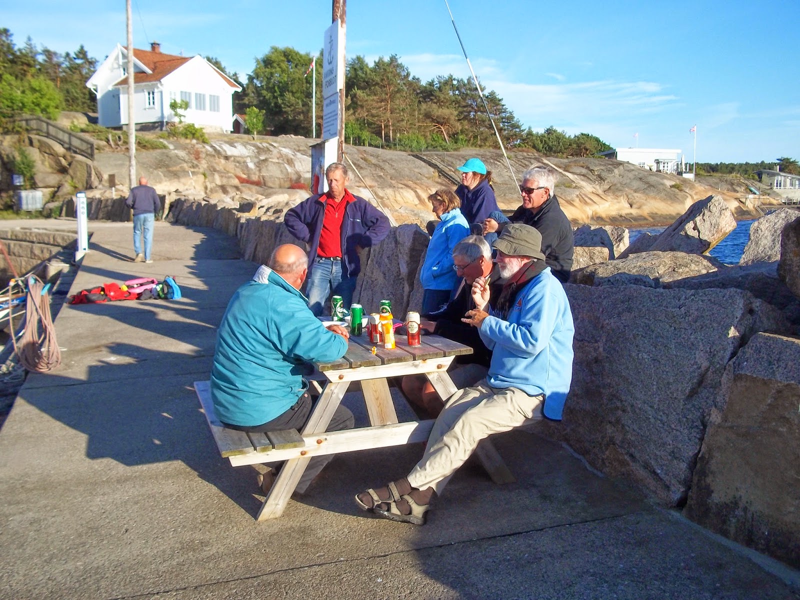 We posted the
card at the ferry’s pier where Tra Bhui was also tied up. After stowing our wet
weather gear which had been drying in the sun we set out northwards again under
motor across the still glass like sea.
We posted the
card at the ferry’s pier where Tra Bhui was also tied up. After stowing our wet
weather gear which had been drying in the sun we set out northwards again under
motor across the still glass like sea.
As we cleared
North Koster we saw the other Drascombes sailing on the horizon. They obviously
had wind while we had none, but soon we too felt a gentle breeze that soon rose
to a sailable wind.
The other boats
had to follow a rather circuitous route towards Engelsvika due to extensive
shallow waters at the mouth of the Oslo Fjord, while we were able to take a
more direct line. While our navigation was reasonably straight forward it was
more challenging for others especially those who were sailing without any
charts!!!!!

 20 miles later
our courses merged and we joined with the line of Drascombes heading towards
Engelsvika. Much to the amusement of everyone Tyboat and Hippo who were well in
front of the group sailed into the wrong
fjord adding to their journey time as they extracted themselves and returned to
the correct heading.
20 miles later
our courses merged and we joined with the line of Drascombes heading towards
Engelsvika. Much to the amusement of everyone Tyboat and Hippo who were well in
front of the group sailed into the wrong
fjord adding to their journey time as they extracted themselves and returned to
the correct heading.
By late
afternoon everyone was berthed in Engelsvika where we had a great impromptu
social evening when we commandeered a picnic table on the breakwater which we
were tied up to and everyone brought along some food or drink.
Miles Sailed = 24
|
Miles Motored = 3
|
Total Miles = 27
|
Wednesday 18th June
Engelsvika
to Skerlaget (anchor) – 31 miles
Wind Easterly 2-3 backing
to Southerly 5-6
|
Dry cloudy / sunny periods
|
Temperature 17 Degrees C
|
 The weather
forecast for the next 2 days (Thursday and Friday) was for up to Force 6 northerly
winds. We would be head on to these winds as we made our way down the Oslo
Fjord and given the steep sides of the Fjord the generally predicted Force 6
could be accelerated in places where the Fjord narrowed. It therefore made
sense to me to try and push on down the Fjord as far as possible today as the
immediate forecast was for Easterly and southerly winds which would allow us to
reach or run all the way.
The weather
forecast for the next 2 days (Thursday and Friday) was for up to Force 6 northerly
winds. We would be head on to these winds as we made our way down the Oslo
Fjord and given the steep sides of the Fjord the generally predicted Force 6
could be accelerated in places where the Fjord narrowed. It therefore made
sense to me to try and push on down the Fjord as far as possible today as the
immediate forecast was for Easterly and southerly winds which would allow us to
reach or run all the way.
At the morning’s
briefing two options were discussed Plan
A) was to have a short sail to Tonsberg to visit a Viking Fort. This would involve only sailing 8 miles or so and
would not take us anywhere nearer Oslo. Tonsberg on the map looked to be a
large town and held little attraction for most of us. Plan B was to sail north to a stop near Son some 21 miles to the
north. This was accepted as the destination my most boats, however being mindful
of our own time constraints I wanted to make the most of the favorable
conditions and head to Skerlaget some 31 miles north. This would leave us only
10 miles or so to Asker where we were due to haul Tra Bhui out of the water on
Friday. This was a distance that we could easily manage even if we were head on
to a force 6 wind on Thursday.

 Passing inside
the small island of Eloya after a mile or so of motoring, we were startled by a
loud blowing noise as a large fish or mammal of some sort rose behind the boat.
Whatever the thing was it followed us for perhaps 500 meters rising 2 or three
times and exposing its dark grey back which had a large dorsal fin. It may have
been a large dolphin - or??
Passing inside
the small island of Eloya after a mile or so of motoring, we were startled by a
loud blowing noise as a large fish or mammal of some sort rose behind the boat.
Whatever the thing was it followed us for perhaps 500 meters rising 2 or three
times and exposing its dark grey back which had a large dorsal fin. It may have
been a large dolphin - or??
As we reached
the lighthouse at Gullolmen (Island ) the wind started to pick up and soon we
were running before a force 5 – force 6 southerly winds and making a pretty
constant 6 knots.
Oslo Fjord is a
busy shipping channel and as such we had to be vigilant for approaching
commercial and pleasure boats. The shortest route to our destination would have
been to cut diagonally across the shipping lanes from the east coast to the
more sheltered west coast, however the quantity of large vessels going in both
directions prevented this and as a consequence we had to take the longer route
outside the curve sticking just inside the northbound lane until we could cross
safety to the west side of the fjord.
 The approach to
the west side of the island of Haoya
where both the north bound and south bound shipping lanes move across to the
east side of the fjord is interesting. Historical fortifications of the adjacent
island of Oscarsborg which has a large fort include an underwater causeway
designed to restrict the channel width. Two channel markers close to the west
shore of the fjord mark the very narrow channel through this barrier. As we
reached the channel we were blasting along at 6.5 knots and with a Swedish
yacht close on our tail our passage though the channel was exciting enough for
both of us.
The approach to
the west side of the island of Haoya
where both the north bound and south bound shipping lanes move across to the
east side of the fjord is interesting. Historical fortifications of the adjacent
island of Oscarsborg which has a large fort include an underwater causeway
designed to restrict the channel width. Two channel markers close to the west
shore of the fjord mark the very narrow channel through this barrier. As we
reached the channel we were blasting along at 6.5 knots and with a Swedish
yacht close on our tail our passage though the channel was exciting enough for
both of us.
After passing
the causeway we dropped our sails in the lee of a small headland and motored
into the sheltered bay at Skerlaget that would be our
anchorage for the night. Instead of an empty bay we found that there was a
handy jetty, BBQ area and composting toilets. Better still it was all free of charge.
Shortly after dropping our anchor and backing into the jetty stern
to we heard on the radio that Damson Moksha, Tyboat and Windroos were also
heading to the bay at Skerlaget having decided sensibly to make the most of the
favorable weather conditions and clock up some miles.

 We also heard on
the radio that shortly after leaving Engelsvika Hippo while following Appuski
Too into a small bay for lunch had lost it’s propeller. Once again the Dutch
boats had gone to the rescue and they were all heading to a nearby marina for
the night with the hope of sourcing a replacement prop.
We also heard on
the radio that shortly after leaving Engelsvika Hippo while following Appuski
Too into a small bay for lunch had lost it’s propeller. Once again the Dutch
boats had gone to the rescue and they were all heading to a nearby marina for
the night with the hope of sourcing a replacement prop.
Obviously if you
are planning a Rally it makes sense to have a number of Dutch boats along as
they are very capable at recovering grounded or broken Drascombes!!!
With Windroos,
Tyboat, Damson and Moksha all tied up alongside Tra Bhui we made good use of
the picnic table on the jetty and had a sociable evening disposing of our
remaining beer and wine.

The fortifications at Oscarsborg
– nothing to do with the Rally although Tyboat and Moksha visited them on the
following day when we headed north.
The narrows at Drøbak,
called Drøbaksundet, are a
natural point for the naval defence of Oslo. The first defences were constructed during the reign of
Christian IV of Denmark and
Norway and were ready in 1644.
Around 1830 the discussion started for a renewed fortification of the Drøbak
Narrows and the first stage was ready in 1848, the next in 1853. The name of
the fortress was given by royal resolution on 23 August 1855 after a visit by
the Swedish-Norwegian King Oscar I.
By the end of the 19th
century the art of war developed rapidly and the new fortress was soon obsolete
and the Norwegians decided to upgrade the fortress. From 1890 new improved
German guns were installed, an underwater barrier was built in 1874–79(this was
the channel we sailed through as referred to above) and an underwater torpedo battery was
constructed.
The main armament was three
28 cm caliber guns manufactured by Krupp. There were also a number of guns with smaller calibers
(15 cm and 57 mm) on the mainland. An underwater barrier went from
the main islet of Kaholmen and south-west to Hurum on the western side of the fjord, thus making it
impossible for large vessels to sail west of the fortress
Having been constructed in
1898–1901, and taken into service on 15 July 1901, the underground
torpedo facility remained one of the few Norwegian defense installations
unknown to German military intelligence at the point of the 9 April 1940
invasion. The battery was one of two in Norway and differed from the other
torpedo battery, at Kvarven Fort, in that it
was designed to launch its torpedoes from under the water level,instead of by torpedo tube from above
ground as was the case with the battery at Kvarven outside Bergen.
At Oscarsborg the torpedo battery
is a concrete construction inside a cave mined into the rock of the North
Kaholmen Island. Two torpedoes are loaded side by side, in two open steel
frames. Then one of the two frames is lowered like an elevator down in the
water to the tunnels below. After one shot, it took some time to swap frames
and be ready for the next. When fired, the torpedo's own compressed air engine
was started and it propelled itself. The battery has three torpedo tunnels
which could fire six torpedoes without reloading and a total of nine torpedoes
were stored and ready for use. Each weapon carried a 100 kg TNT warhead and targets were spotted from three observation
bunkers just above the battery.
When Norway was invaded on 9 April 1940, all of the fortress' armament was over
40 years old, and of German origin. Both
the guns and the torpedo battery worked flawlessly when Oscarsborg encountered
one of the German invasion flotillas; they sank the heavy cruiser Blücher, and threw
back the German naval force heading for Oslo, thus managing to save the
Norwegian King and government from being taken prisoner. During the occupation of
Norway German forces were
stationed at Oscarsborg
 The fortress was returned to
Norwegian control on 12 May 1945 when Captain Thorleif Unneberg took command of
the fortifications and raised the Norwegian flag following the capitulation of
all German forces in Norway four days earlier. The flag in question was the
same that had flown over the fortress until it was captured by the Germans in
April 1940.
The fortress was returned to
Norwegian control on 12 May 1945 when Captain Thorleif Unneberg took command of
the fortifications and raised the Norwegian flag following the capitulation of
all German forces in Norway four days earlier. The flag in question was the
same that had flown over the fortress until it was captured by the Germans in
April 1940.
During the Cold War Oscarsborg
formed a last line of defense for the capital city, with the underground
torpedo battery remaining secretly active up until 1 January 1993, having been
modernized in the 1980s.
After the deactivation of
the last weapons systems, the remaining military activity on Oscarsborg
consisted of the Coastal Artillery officer training programme. The officer
school was officially shut down on 28 June 2002.
Miles Sailed = 25
|
Miles Motored = 6
|
Total Miles = 31
|
Thursday 19th June
Skerlaget to
Asker (Oslo) – 8 miles
Wind Northerly Force 5-6
|
Rain showers in the morning
getting heavier in the afternoon
|
Temperature 17 degrees C
|
We awoke to grey
skies and a blustery northerly wind and the noise of Damson preparing to leave.
Simon and Ian were heading into Oslo early as Simon hoped to fly down to
Copenhagen and then by train to Roskilde to collect his car and trailer.
 Rain was not far
away and with only 8 miles or so to go today we decided to have a walk and
explore the forested area around the bay in which we were anchored before it
rained. After a couple of hours scrambling along what the Norwegians jokingly
call footpaths we hauled in the anchor for the last time and headed out of the
bay towards the Asker Yacht Club, leaving Tyboat, Windroos and Moksha moored in
the bay.
Rain was not far
away and with only 8 miles or so to go today we decided to have a walk and
explore the forested area around the bay in which we were anchored before it
rained. After a couple of hours scrambling along what the Norwegians jokingly
call footpaths we hauled in the anchor for the last time and headed out of the
bay towards the Asker Yacht Club, leaving Tyboat, Windroos and Moksha moored in
the bay.
It is worth
noting that Jack on Tyboat had sailed the whole route with only a small
electric battery and hi large sculling oar as alternative power. This was a
fair achievement and while perhaps not something that we will be trying is
still worth a mention.
The wind was on
the nose and with initially a number of reefs to negotiate we decided not to
raise the sails until we were clear of the island of Haoya, by which time the
wind was dropping away, so we ended up motoring all the way to Asker.
 Yacht Club
is an impressive place and has literally hundreds of yachts and large motor
cruisers berthed by its pontoons. We arrived there early afternoon just in time
for a heavy thunderstorm to hit us. As
we were both wearing our full wet weather gear the rain was not particularly
unpleasant and Tra Bhui benefited from a good dousing of fresh water to remove
some of the salt that had built up over the last three weeks.
Yacht Club
is an impressive place and has literally hundreds of yachts and large motor
cruisers berthed by its pontoons. We arrived there early afternoon just in time
for a heavy thunderstorm to hit us. As
we were both wearing our full wet weather gear the rain was not particularly
unpleasant and Tra Bhui benefited from a good dousing of fresh water to remove
some of the salt that had built up over the last three weeks. Being unsure
where to berth we went with Kathleen’s suggestion of the innermost pontoons,
which was just as well as where I wanted to tie up we would have been stuck
behind a large security gate! Once alongside we went to find the marina office
to get directions to the visitor’s berths only to be told that it was a private
club and there were no facilities for visitors!
Being unsure
where to berth we went with Kathleen’s suggestion of the innermost pontoons,
which was just as well as where I wanted to tie up we would have been stuck
behind a large security gate! Once alongside we went to find the marina office
to get directions to the visitor’s berths only to be told that it was a private
club and there were no facilities for visitors!
After looking
out at our boat and taking into account the water that was running of our
waterproofs and creating large pools of water in her office, the manageress
agreed we could leave Tra Bhui alongside a pontoon for the night as we were not
taking anyone’s space and we did not need shore facilities. As there would not
even be a charge it was a Great Result!
 Having promised
Kathleen a dry bed and a shower so that she could go home in a presentable
state, our next stop was to find a hotel. Looking at the sky I thought another
heavy shower was imminent, but stupidly took my crew’s assertion that it would
be dry as being believable. I left my
waterproofs on the boat (as did she) before we set out into town. Needless to
say after walking 500m the entire rainfall for Norway for a year dropped from
the sky in the course of 20 minutes. Getting soaked does not adequately describe
how wet we got!
Having promised
Kathleen a dry bed and a shower so that she could go home in a presentable
state, our next stop was to find a hotel. Looking at the sky I thought another
heavy shower was imminent, but stupidly took my crew’s assertion that it would
be dry as being believable. I left my
waterproofs on the boat (as did she) before we set out into town. Needless to
say after walking 500m the entire rainfall for Norway for a year dropped from
the sky in the course of 20 minutes. Getting soaked does not adequately describe
how wet we got!
As the rain
tailed off we found a hotel which was local and affordable. Returning to Tra
Bhui we gathered our wash kit and clean clothes before checking in.
That evening we
climbed up to the town center and enjoyed a meal at a Norwegian / Italian
restaurant
Miles Sailed = 0
|
Miles Motored =8
|
Total Miles = 8
|
Total Miles Sailed = 279
|
Total Miles Motored = 90
|
Total Miles during Rally= 369
|
.
Friday 20th June
Asker to
Airport and home
After the luxury
of a long lie – Damson and crew were not alongside – and a buffet breakfast we
put our sailing clothes back on and headed back to the Yacht Club to get Tra
Bhui ready to be hauled out. Time,
weather and lack of enthusiasm from
the crew prevented a major clean up, but as far as possible we laid stuff out
to dry as everything was going to be left in my car for the next 6 weeks or so
and we did not mold to grow on damp kit. The sails which were heavily encrusted
with salt were treated to a wash courtesy of the pontoon’s hose pipe as was Tra
Bhui’s deck and woodwork.
Tim arrived just
before 10am to pick me up and take me back to his house which was about 10 minutes away to collect the car and
trailer. Despite the car and trailer being parked at the end of a very quiet
and wide road which served only a few houses, a vehicle (thought to be a
council dust cart) had driven into the side of the trailer bending the nearside
mudguard and brackets. Luckily the mudguard was still clear of the wheel and
would be OK for the drive home, but some repairs would be needed before heading
to our next planned rally in Ireland. The only consolation albeit small was the
offending vehicle would not have got off unmarked and hopefully the offending
driver would have some explaining to do to someone!
Back at the marina
Tra Bhui was soon out of the water and being de rigged. The pile of stuff that
we unloaded to be reloaded into the car was impressive. Due to the good weather
we had not worn half of the clothes that we had taken with us, nor used nearly
as much fuel in the stoves as predicted. If the weather had been poor I am sure
everything we took would have been used.
All good things
must come to an end! After parking Tra Bhui, car and trailer outside Tim’s house we headed on
foot towards the train station in Asker, Kathleen with her clean clothes which
were unworn and me with three weeks of combined dirty washing (customs were not
going to be rummaging through my bag!)
We stopped in
Asker for a coffee and then took the train to the airport, arriving back in Edinburgh
at 9pm UK time.
We had had a
great three weeks, sailed in fantastic surroundings, enjoyed mainly favorable
winds and weather and met some great people. We travelled by boat for 369 miles
and sailed approx. ?????? of them.
At the time of
writing this Tra Bhui is ready and waiting on her trailer for her next
adventure which will be the Baltimore Rally in Southern Ireland in August. DMcW June 2014
Total Miles 369

Appendix No 1
Documents
1. Car
1.
Registration Documents
2.
Insurance Document
3.
MOT
4.
Breakdown Cover
5.
Contact Numbers – Breakdown,
Insurance
6.
Route Details - see tickets
2. Boat – Ships Papers
1.
Registration Document (RYA
advise carrying the original as well as a photocopy)
2.
Proof of ownership
3.
Ships Radio license (to cover
VHF, EPIRB and PLBs)
4.
Insurance
5.
Proof of VAT Status
6.
CE Mark on boat if manufactured
after 16th June 1998 under the Recreational Craft Directive (applicable to all
craft manufactured after 16th June 1998). If manufactured before this date,
proof of exemption - i.e. some form of document proving that boat was built or
was in use before then.
7.
Proof of authority to operate a
VHF radio - i.e. personal radio license - one per boat with a radio
8.
A copy of the International
Regulations for Preventing Collisions at Sea (COLREGs) should be carried on-board.- Norwegian Requirement
3. Personal
1.
Passport
2.
European Health Card (EHIC) -
optional
3.
Personal Insurance – optional
4.
ICC / Day Skipper Qualifications
5.
Tickets
6.
Hotel Bookings
Appendix No 2
Kit List for Boat
Boat
|
Car
|
Tool Box
|
|
Mask Snorkel
|
Tender
|
Long Bar
|
Screw Drivers
|
Handheld VHF + charger
|
Tender pump
|
Wheel sockets
|
Plug Spanner
|
Handheld Compass
|
Electric pump
|
Recovery Rope
|
Outboard Manual
|
Fillet Knife
|
Electric pump adaptors
|
Multi meter
|
|
Dive Knife
|
Boat hook
|
Saw
|
|
Meths
|
Rowlocks
|
Spanners
|
|
Fuel Bottles
|
Fenders
|
Sockets
|
|
Electric Light +charger
|
Over cover
|
Self-annealing tape
|
|
Toilet Fluid
|
Cockpit cover
|
Insulating tape
|
|
Lifejackets
|
Ball and cone
|
Hammer
|
|
PLBs
|
Fire extinguisher
|
Soldering Iron
|
|
Handheld VHF
|
Binoculars
|
Solder
|
|
Flares
|
Ladder
|
Magnet
|
|
Torch
|
Courtesy flags
|
Screws
|
|
Lifelines
|
Red Ensign
|
Epoxy Putty
|
|
Water containers
|
Radar reflector
|
||
Umbrella
|
Fog horn
|
||
Fuel Tanks
|
Bucket (s)
|
Spares
|
|
Sea Anchor
|
Thermal Shower
|
Plugs
|
|
Toilet Fluid
|
Kite
|
Impeller
|
|
Spray dodger
|
Anchors (2)
|
Engine electrics
|
|
Tender oars
|
Warps
|
Rigging fittings
|
|
Boat Oars
|
Buoy for trip line
|
Screws
|
|
Sunshade
|
Tent
|
Bolts
|
|
Navigation
|
Tent poles
|
Misc Fittings
|
|
Charts
|
Basin
|
||
Almanac
|
Toilet fluids
|
||
Course plotter
|
Long mooring lines x 6
|
||
Dividers
|
Short mooring lines x 4
|
||
Pencils
|
|||
Rubber
|
|||
Pencil sharpener
|
|||
Garmin
|
|||
Chart chip
|
|||
Chart case
|
|||
Barrel 1
|
Barrel 2
|
Barrel 3
|
Barrel 4
|
Wet weather gear
|
Sleeping bag x 2
|
Clothes Kathleen
|
Clothes David
|
Gortex Bivy Bag x 2
|
|||
Pillows x 4
|
|||
Mosquito Net x 1
|
|||
Therma rest x 2
|
|||
Box 1
|
Box 2
|
Box 3
|
Box 5
|
Plates Large x 4
|
Washing powder
|
Tinned Food
|
Trangia
|
Plates Small x 4
|
Fairy Liquid
|
Handy Fuel
|
|
Mugs x 4
|
Pan Cleaners
|
Cooking utensils
|
|
Cooking Utensils
|
Dish Towels
|
Matches
|
|
Knife / Fork / Spoon x 2
|
Baby wipes
|
Plates
|
|
Washing up liquid
|
Bin bags
|
Wine glasses
|
|
Nappy bags
|
Cutlery
|
||
Kilmos
|
Mugs
|
||
Clothes pegs
|
Flask
|
||
Water bottles
|
|||
Box 6
|
Box 7
|
Box 8
|
Box 9
|
T Bags
|
Fruit Cake
|
Rice
|
Wine & Spirits
|
Coffee
|
Nuts
|
Pasta
|
Beer
|
Sugar
|
Chocolate
|
Breads
|
|
Coffee
|
Biscuits
|
Packets
|
|
Salt
|
|||
Mustard
|
|||
Olive oil
|
|||
Box 10
|
|||
Camera equipment
|
|||
Appendix No 3
Acknowledgements
1.
Simon on Damson who provided me
with a record of the wind speed s every day as Tra Bhui has at present to wind
speed instrumentation
2.
Everyone on the Rally for
providing great company
3.
Wikipedia for some local
information – Google for the rest
Appendix No 4
Overview
of the Geography of the Countries visited
Denmark
Located in Northern Europe, Denmar consists of the
peninsula of Jutland and 443 named islands (1,419 islands above 100 square meters
(1,100 sq. ft.) in total) Of these, 72 are inhabited with the largest
being Zealand and Funen. The island of Bornholm is located
east of the rest of the country, in the Baltic Sea. Many of the
larger islands are connected by bridges; the Øresund Bridge connects
Zealand with Swede (we crossed this taking the trailer up to Oslo); the Great Belt Bridge connects Funen with Zealan(I crossed this when driving
from Amsterdam to Roskilde); and the Little Belt Bridge connects Jutland with Funen.(again I crossed this when
driving from Amsterdam to Roskilde) Ferries or small aircraft connect to
the smaller islands. The largest cities with populations over 100,000 are the capital Copenhagen on Zealand; Aarhus and Aalborg in Jutland;
and Odense on Funen.The country occupies a total area of 43,094 square kilometres (16,639 sq. miles) The size of the land area cannot be stated exactly since the ocean constantly erodes and adds material to the coastline, and because of human land reclamation projects (to counter erosion). A circle enclosing the same area as Denmark would be 234 kilometres (more than 145 miles) in diameter with a circumference of 742 km (461 mi). It shares a border of 68 kilometres (42 miles) with Germany to the south and is otherwise surrounded by 7,314 km (4,545 miles) of tidal shoreline (including small bays and inlets). No location in Denmark is further from the coast than 52 km (32 miles). On the south-west coast of Jutland, the tide is between 1 and 2 m (3.28 and 6.56 ft.), and the tideline moves outward and inward on a 10 km (6.2 mi) stretch.
The country is flat with little elevation; having an average height above sea level of 31 meters (102 ft.). The highest natural point is Møllehøj, at 170.86 meters (560.56 ft.) A sizeable portion of Denmark's terrain consists of rolling plains whilst the coastline is sandy, with large dunes in northern Jutland. Although once extensively forested, today Denmark largely consists of arable land. The country is drained by a dozen or so rivers, and the most significant include the Gudenå, Odense, Skjern, Suså and Vidå—a river that flows along its southern border with Germany.
The Kingdom of Denmark also includes the much larger, self-governing territory of Greenland, situated near North America and the autonomous territory of the Faroe Islands in the North Atlantic Ocean.
Sweden
Sweden lies west of the Baltic Sea and Gulf of Bothnia, providing a long coastline, and forms the eastern part
of the Scandinavian Peninsula. To the west is the Scandinavian mountain chain (Skanderna), a range that separates Sweden from Norway. Finland is located to
its north-east. It has maritime borders with Denmark, Germany, Poland, Russia, Lithuania, Latvia and Estonia, and it is
also linked to Denmark (south-west) by the Öresund Bridge. Its border
with Norway (1,619 km long) is the longest uninterrupted border within Europe.At 449,964 km2 (173,732 sq. miles), Sweden is the 55th-largest country in the world, the 4th-largest country entirely in Europe, and the largest in Northern Europe. About 15% of Sweden lies north of the Arctic Circle. Southern Sweden is predominantly agricultural, with increasing forest coverage northward. Around 65% of Sweden's total land area is covered with forests. The highest population density is in the Öresund Region in southern Sweden, along the western coast up to central Bohuslän, and in the valley of lake Mälaren and Stockholm.
Norway
Norway comprises the western
part of Scandinavia in Northern Europe. The rugged coastline, broken by huge fjords and thousands
of islands, stretches 25,000 kilometres (16,000 miles) and
83,000 kilometres (52,000 miles) and include fjords and islands. Norway
shares a 1,619-kilometre (1,006 miles) land border with Sweden, 727
kilometres (452 miles) with Finland, and 196 kilometres (122 miles) with Russia to the east.
To the north, west and south, Norway is bordered by the Barents Sea, the Norwegian Sea, the North Sea, and Skagerrak.
At 385,252 square kilometres
(148,747 sq. miles) (including Svalbard and Jan Mayen) (and 323,802
square kilometres (125,021 sq. miles) without), much of the country
is dominated by mountainous or high terrain, with a great variety of natural
features caused by prehistoric glaciers and varied topography. The most
noticeable of these are the fjords: deep grooves cut into the land flooded by
the sea following the end of the Ice Age. The longest is Sognefjorden at 204
kilometres (127 miles). Sognefjorden is the world's second deepest fjord,
and the world's longest. Hornindalsvatnet is the deepest lake in all Europe Frozen ground can be found
all year in the higher mountain areas and in the interior of Finnmark county. Numerous glaciers are found in Norway.
The land is mostly made of
hard granite and gneiss rock, but slate, sandstone, and limestone are also
common, and the lowest elevations contain marine deposits. Because of the Gulf Stream and prevailing westerly winds, Norway experiences higher
temperatures and more precipitation than expected at such northern latitudes,
especially along the coast. The mainland experiences four distinct seasons,
with colder winters and less precipitation inland. The northernmost part has a
mostly maritime Subarctic climate, while Svalbard has an Arctic tundra climate.
Because of the large
latitudinal range of the country and the varied topography and climate, Norway
has a larger number of different habitats than almost any other European country. There are
approximately 60,000 species in Norway and adjacent waters (excluding bacteria
and virus).