Saturday 2nd July
Comfort
is I suppose a relative thing and sleeping on the passageway floor of the
ferry, while not as good as sleeping in a bed was I suppose better than
sleeping outside! I woke around 6 am and got up. Kathleen on the other hand was
obviously far comfier than I had been and lay still until nearly 8 am before
finally making a move.
The
ferry it appeared had not made up any time and was still running about 3 hrs.
late. Our scheduled arrival in Italy just after 8 am was now going to be around
11 am, but as were heading to a campsite only a few miles away we were not in
any hurry so the delay was not really going to cause us a problem.
In
search of breakfast we headed below to the main lounge which was already
partially occupied by truck drivers and which was now starting to fill with
fellow passengers. Breakfast consisted of a coffee from a machine and a
croissant. Not the greatest breakfast nor the cheapest, but perfectly OK. The
lounge was filling up and the arrival of a large party of adults and children
at the table next to ours drove us upstairs as they took over all the space
around us.
 |
| Entering Brindisi |
Historically,
the city has played an important role in trade and culture, due to its
strategic position on the Italian Peninsula and its natural port on the
Adriatic Sea. The city remains a major port for trade with Greece and the Middle
East making it reasonably busy and prosperous. With a history going back nearly
2000 years the city contains a number of old buildings and lively waterfront
which were looking forward to exploring later
 |
| Waiting to reverse off |
 |
| Nearly our turn |
 |
| Chaos as disembarking starts |
The
campsite should have been easy to find as it was supposed to be located just
off the main road, however it wasn’t! Despite spending an hour or so driving up
and down numerous side roads and asking a number of locals for directions (none
of whom had ever heard of the campsite) we never did find it. We spent another
hour investigating other camping options, but all the campsites were on the
coast and from what we could see they were all contained within large walled
compounds and were more chalet parks than proper campsites. Eventually we gave
up and having bought bread and cold drinks at a small bakery for lunch we
revised our plans.
With
the coastline to the north of Brindisi proving to be fairly well developed and
lacking in suitable campsites we decided to head further north, hoping to find
a quieter stretch of coast. As I drove, Kathleen got onto the internet to see
what our options were and soon came up with what looked to be a good
alternative –Camping Adriatico!
 |
At Cerignola
we turned off the SS16 onto the smaller SP77 and headed westwards to Manfredonia
where we then joined the SS89 and continued westwards to Vieste.
The
SS89 was shown on our map to be a scenic route with great coastal views. What
our map failed to show in detail were the roads numerous bends or its climbs
and descents as it followed the coastline a bit too closely.
Vieste
sits at the end of the large peninsula that sticks out on the Italian coast
into the Adriatic which is the Parco Nazionale del Gargano. The peninsula is sometimes
described as the spur on the heel of the Italian boot
Named
after Mount Gargano the park includes nearby the Tremiti Islands archipelago
and the Foresta Umbra. We found the steep hills and dense vegetation to be a
stark contrast to the flat agricultural landscape that we had driven through
since leaving Brindisi.
Just
as we arriving in Vieste we found Camping Adriatico without any problem.
 |
| On our pitch at Camping Adriatico |
Each
pitch abutted the adjoin one and was accessible from a very narrow dirt road
along the front of it. A decent sized motor home, caravan or tent complete with
awning would cover the entirety of a pitch. With awnings and sunshades touching
the adjacent caravan or motor home, the site soon began to look extremely
crowded, but luckily the pitches immediately around us stayed empty while we
were there.
 |
| Walking along the beach to the nearby town |
It
had been a long day by the time we were set up on our pitch. Having sat in the
car for too long we set off to walk to town for a quick look around.
The
town itself was 1.5 miles away and was easily reachable by walking along the
wide promenade that stretched past our campsite. Being in Italy we stopped at a
small bar and sat outside to enjoy an Aperol Spritz, currently a trendy drink
in the UK which originates in Italy. The colour of an Aperol Spritz is similar
to Irn Bru – a truly Scottish Drink. The taste is not unpleasant but I would
rate it slightly lower than Irn Btu – something that I do not choose to drink
very often.
We
sat for a while enjoying our drinks and watching the shadows gradually lengthen
and then disappear as the sun dipped below the surrounding buildings, before we
headed back.
We
stopped for dinner at a seaside restaurant where we both enjoyed really good
pizzas made outside in a traditional wood burning oven. Italy is definitely the
home of the pizza!
Sunday 3rd July
Having
finished a leisurely breakfast we had some shopping to do. We planned to spend
the next three weeks or so travelling back home and we decided that buying a
table and two chairs was a justifiable extravagance!
We
walked back into town and started our search. Having no idea where we would
find suitable chairs and a table we headed away from the towns historic centre
towards the area where we thought that there would be more shops selling
household goods as opposed to main street fashion and high value goods.
Our
wanderings led us to a number of shops selling chairs, but either they were
unsuitable or fantastically overpriced. Eventually we came to a shop that had
just what we were looking for. It being Sunday the shop was going to close at
13.00hrs. As it was now just after 11.00 hrs. we decided to explore this area a
bit further, find a cold drink and think about the table and chairs that we had
just seen before committing to a purchase.
 |
| The streets in the old town reminded us of Malta |
We
walked to the nearby harbour where there is a large marina and from where the
numerous day boats leave from to take tourists to see some nearby sea caves.
The harbour was disappointing, much larger than the small harbours that we had
spent the last three months visiting in Greece and far too commercial for our
liking. From the harbour we walked through an older part of the town which
actually reminded us of the steep streets in Valletta (Malta) as we headed back
towards the shop with the table and chairs.
 |
| Taking a break on the walk back with our new table and chairs |
Now
being the proud owners of a square white plastic table and two pretty good
metal and canvas director chairs (Kathleen’s choice) we had to carry them the
2.3 miles back to the campsite. The first mile or so was fairly easy going but
as we progressed the table and chairs which were awkward to carry appeared to
get heavier. The last mile was broken into stages as we set ourselves a target,
normally a bit of shade, to head to. Target reached we rewarded ourselves with
being able to stop and change our grip or swap hands before setting out for a
new target a few hundred yards further on.
Before
we reached the campsite, Kathleen left me with the table and chairs while she
rushed to a nearby shop to buy the makings of lunch before it to shut for the
afternoon. Left with only a few hundred metres to go one last push saw me back
at our pitch with our new furniture and by the time Kathleen arrived I had
assembled it and was trying it out.
After
lunch we went for a swim in the sea. As the campsite was right on the beach we
only had to walk 100m or so through the campsite and across the very hot sand
before we were in the warm water of the Adriatic.
 |
| The walls of the old town |
Later
we walked back into town for dinner, stopping just outside the walls of the old
town for another Aperol Spritz at a bar overlooking the lighthouse that stands
just off the harbour mouth.
We
ate dinner at a restaurant just below the bar that we had just left. The tables
were set out along a terrace with views over the town.
Monday 4th
July
After
a lazy early morning on the pitch we walked along the beach to the town stopping
on the way to buy frozen yogurts. This would be our last day in Vieste as we
planned to head north again tomorrow and we wanted to see a bit of the town
before we left.
Vieste
is primarily a beach resort and a popular destination for holidaymakers during
the summer season. The town with it’s steep, cobbled streets that spill down
the hillside sits on top of a small hill overlooking the one of the area’s most
spectacular beaches - Castello.
 |
| Looking eastwards from the old town over Castello Beach |
We
were staying at the far end of this beach and our daily walk into town was
along it at the town end of the beach, a 25 m high monolith rises from the sea.
It is known as Pizzomunno, and is almost a symbol of Vieste itself.
There
is a legend of tragic love about the rock. In remote times, when the town was
only a small fishermen's village, a young, strong man named Pizzomunno loved a
beautiful girl named Cristalda (some versions call her Vesta or Vieste), who
had long, beautiful hair of the color of the sun.
Every
day Pizzomunno went to the sea with his ship to fish, and every day mermaids
tried to seduce him with their songs. They even offered him immortality and the
honor of being their king. But Pizzomunno always returned to his beloved Cristalda.
One night, as the two lovers were together on an islet near the coast, the
mermaids attacked Cristalda and pulled her down to the sea bottom. Pizzomunno
tried in vain to save her. The following morning he was found on the beach,
transformed by his anguish into the white cliff that still bears his name. All
is not lost, however, as tradition has it that every 100 years Cristalda rises
from the abyss for one night to join her young lover again.
 |
| An abandoned fishing station |
The
upper part of the town is the Old Town surrounded by a wall within which sits a
castle. The was built by Emperor Frederick II, by whom the Gargano peninsula
was particularly favoured. The development of military warfare and the
incursions of the Turkish fleet later made it necessary to strengthen the
defensive system with bastions and walls with escarpments, embrasures and
ramparts, and similar fortresses were constructed throughout the region. In
1648 an earthquake seriously damaged the castle. It is now occupied by a
military installation.
 |
| The cathedral |
Amongst
the many churches in the Old Town there is an 11th Century
Cathedral, built on what is thought to have been the site of a pre-Christian
temple, the cathedral has been extensively altered and extended over the
centuries, however, the nave and the two side aisles still maintain their
original form, as does the north wall and its door.
Many
coastal towers were erected in the 16th century to defend the Kingdom of Naples
against Turkish marauders. The alarm was given by firing small cannons and the
display of warning signals. The towers in Vieste date back to 1568, but several
of them had been abandoned by the end of the 18th century.
 |
 |
| The narrow streets within walls of the old town |
In
1554 around 5,000 inhabitants were executed by the Turks, on the grounds that
they were too elderly or infirm to merit transportation into slavery. This
event is commemorated annually in a ceremony, which has now degenerated into a
kind of summer Halloween.
 |
| One of many churches |
After
a pleasant wander around the Old Town we made our back to the campsite,
stopping en route for a late lunch at one of the beach bars that we passed.
 |
The
rest of the afternoon we spend doing not a lot apart from swimming and reading.
As arranged with the campsite manager at 19.00 hrs. we moved Tra Bhui from the
back of the campsite to a more accessible parking spot as we planned to leave
sharply in the morning and we did not want to risk Tra Bhui being blocked in
with cars parked near her overnight.
We
ate dinner at our pitch to celebrate out new table and chairs after which we
packed up most of our gear ready to move on in the morning.
Tuesday 5th July
Today was our
“Pearl ‘Anniversary – 30 years !!!
Packed
up and ready to go we had to wait a few minutes until the campsite gates re
opened before we could cross the road to the other part of the campsite and
hitch up Tra Bhui.
By
07.20 we were on our way. The first part of our journey was to head north east
towards the A14 Autostrada which we would use to take us north. To get to the
A14 however we first had to get travel along the SS89 again and then the SS683.
We hoped that the SS89 north of Vieste would be a lot flatter and straighter
than it had been when we arrived at Vieste on it from the south. It wasn’t! In
fact if anything it was even more torturous with numerous step climbs, sharp
hairpin bends and very narrow sections. It was not until we reached the SS683
that the road showed any signs of improvement.
The first 30 miles of our journey took us 1.5 hrs. and we were not even
stuck in traffic!
Once
we got to the A14 we managed to make good time as we headed north. We stayed on the A14 as it followed the
coastline to Rimini after which it turned inland and becomes the A45 just
before it reaches Bologna. We stayed on the A45 as it swept around Bologna and
on to Modena.
It
would have been great to have the flexibility to stop and visit the towns that
we passed, but towing Tra Bhui meant that finding stopping places in towns was
a bit of a mission and so we were resigned to leapfrogging from campsite to
campsite. We could leave Tra Bhui at the campsite use it as a base to explore
the immediate area. This was of course a
bit of a compromise and we plan to one day return and see all the places we
missed out.
From
Modena we took the E45 / A22 northwards towards the border with Austria. Now
that we were back in Italy we were navigating using our Sat Nav – our trusty
Tom Tom that was by now 8 years old and which had had the mapping updated since
we bought it. Occasionally we found a few errors where new roads had been built
or where existing roads had been reconfigured. This generally resulted in the
Tom Tom thinking we were driving through a field and subsequently performing
continuous and enormous route calculations until we eventually regained an
unaltered road.
I
would like to be able to blame us getting lost on our outdated mapping or on
some other external influence, but I cannot. I put the wrong part of the
campsite address into the Tom Tom as our destination. This resulted in us
driving past the exit we needed and heading to a town 30 miles or so further
on. The town being the region’s main town and also having the same name as the
region.
To
make matters worse Kathleen having put the campsite into the route finder on
her phone, told me that we should take the correct exit, before we got to it,
but not wanting to depart from the route that I erroneously though was the
correct one, I decided to stay on the A22 rather than turn off.
My
mistake became all too apparent when we ended up in the centre of Bolzano which
was obviously not a mountain top campsite.
I
wish I could say that Kathleen refrained from mentioning my mistake, but I
cannot. The rain started to fall as we turned back and headed south on the A22
adding another hour and a half on to what was proving to be a long days drive.
30
miles later at Trento we left the A22 and headed eastwards in the darkness
along the SP60 towards Borgo Valsugana. By now the rain had become both heavy
and constant which combined with lack of a moon and a clear sky meant we could
see little beyond the sweep of the headlights. Not exactly a scenic drive into
the mountains!
Leaving
the SP60 at Borgo Valsugana we started the long climb up ever smaller roads
through Pieve to our eventual destination - Camping Valmalane.
 |
| Our room with a view |
Eventually
we arrived at the campsite. The final section of the road had been effectively
single track, something that did not appear to slow local traffic down at all
which resulted in a few instances where we had to take to the verge to avoid a
collision as there was no way the approaching vehicle was going to stop in time.
This did not do much to lift Kathleen’s spirits which had been low since we had
taken the wrong rout hours before and not surprisingly she had on a number of
occasions questioned the sensibility of towing Tra Bhui up to a mountain top
in the Dolomites.
We had booked the campsite through an Internet
site called Pitchup. We had not used it before this trip but we found it pretty
good with a fairly comprehensive coverage of sites throughout Europe. Camping Valmalane was advertised as:_
“Literally immersed
in the green Sugana Valley and surrounded woods and mountains, Camping
Valmalene welcomes you to spend a relaxing holiday surrounded by nature.
The campsite
offers modern facilities including toilet blocks and family-friendly
facilities, a restaurant pizzeria and a bar, a grocery shop and a tennis court.
In summer, guests can relax in the outdoor swimming pool, play pétanque or have
fun in the games room. There is also an outdoor playground for the children.
For a bit of
pampering, head to the wellness centre for a sauna, a steam bath or a relax
room.”
Arriving
in the rain we checked in and went to find a pitch. As well as the more formal
pitch the campsite which sat on the hillside had a large flat camping field at
the bottom of it which was ideal for us.
With
Tra Bhui unhitched and the roof tent up we walked back up the hill to the
campsites restaurant for a well-earned beer and some pizza.
Happy Anniversary!
Wednesday 6th July
We
woke to clear blue skies and sunshine. Kathleen decided that we would be better
camped in a different location in the field so Tra Bhui was hitched back up and
we moved to what actually was a better location, where we set up camp. The
campsite shop provided us with bread and eggs for breakfast so we sat in the
sunshine enjoying it surrounded by some fantastic mountain scenery.
 |
| The almost deserted streets of Pieve |
After
breakfast we decided to walk down to Pieve 3.5 miles away down the valley as we
needed some shopping. We arrived in Pieve just as the shops were shutting for
lunch. After finding a Wi-Fi connection outside a hotel and catching up on some
e-mails we decided that it was time for our lunch. A walk around the village
identified only one likely place to eat – a small hotel. Here we enjoyed cheese
rolls on a small terrace outside the door to the bar.
 |
| Lunchtime |
Lunch
over Kathleen suggested that we should walk to the castle in nearby Castello
Tesino which was only 2 miles or so away (uphill). So of we went to visit the
castle. Today however it was Kathleen’s turn to have a navigation error. There
was no castle! Castello was just the name of the village. Still after getting
off the main road we did have a nice walk min the country side and the village
which was on top of a very steep hill did have some fine views – but no castle!
 |
| View from Castello - the town with no castle! |
 |
Walking
back to Pieve Kathleen decided to take an alternative route, choosing to follow
a footpath that would bypass Pieve and thus avoid having to walk along the main
road. As we needed to visit a shop I took the main road into town having
arranged with Kathleen where we would meet later.
The
shops in Pieve were open again when I arrived there, but they may as well have
been shut as they offered nothing that we were looking for and so all I bought
was two bottles of water.
 |
| Pieve |
 |
| A wild strawberry - not large but tasty! |
We
needed to shop as we were out of just about everything and as we wanted to see
a bit more of the local area we lowered the roof tent and set out by car to
explore.
When
we drove into the mountains on Tuesday evening, one of the things we had seen
was a reasonably sized lake. Not really knowing the area we thought that this would
be a reasonable destination to head for as the route to it would take us
through some small towns where there was bound to be a supermarket.
Back
on the SP133 and just west of Borgo Valsugana we saw a supermarket and pulled
in to do some food shopping. We ended up getting everything we wanted, but not
having a cool box or a fridge we refrained from buying any fresh stuff just
yet. We would stop again on later as anything bought now would be in a hot car
all day. A fridge would really be an asset when camping in the summer.

After
food shopping we had a look at the small selection of shops in the mall where
the supermarket and then had a coffee before resuming our day exploring. The
lake we had seen previously was Lago di Caldonazzo. With no real planned route,
were heading generally towards it but we actually ended up at the adjacent and
much smaller Lago di Levico. The lake
had a single beach, behind which was a large village. The village itself was
pretty bland and featureless so we continued westwards until we came to the
town of Pergine Valsugana.

After
the fall of the Western Roman Pergine became part of the Lombard Duchy of
Trento. The first record of the town of Pergine was made in 845
 |
| The Castle of Pergine |
Since
then the town has played it’s part in history of the area which has been ruled
by a number of different entities over the years. The Castle of Pergine stands
on the hill behind the town which meant that there was something for Kathleen
to walk me to after lunch.


The
town itself contains many old buildings which make it an interesting place to
walk around. We stopped for lunch in the town’s virtually deserted square after
which Kathleen decided we should climb up to the castle.
 |
| The Castle is now a hotel |
The path to the castle
is steep – very steep! The castle which is currently a hotel was restored in 20th
Century amid some controversy as the restoration was not felt to be sympathetic
to the building. The end result has at least meant that the castle has a new
lease of life although I am not sure if what we see today reflects the building
that has stood on the site for the last 1500 hundred years or so.


The
castle did offer good views and a place to sit and read our books for a bit
before walking back down to the town.
 |
| Making good use of the public art on display |
We
headed back to the campsite via Lago di Caldonazzo, but we stayed on the main
road and did not see any reason to stop there. We did however stop at a small
supermarket near Borgo Valsugana to buy fresh foodstuffs. As a special treat I
was allowed to buy a basin in which to wash the dishes – lucky me.
After
dinner and dishes (in new basin) we went for a walk around the campsite where
we saw some amazing fireflies. This was the first time that I had seen
fireflies so it was a pretty memorable sight.
Friday 8th
July
With
our morning chores completed we set out for a local walk. We had been given a
guide to local footpaths when we checked in to the campsite, but it was really
not anything more than an indication of where the footpaths went to and was not
a map we could actually use for navigation. The map did however indicate that
there we a couple of cable cars nearby. We consulted our guide book which was
not very clear on whether the cable cars would be open or not, in fact not all
the cable cars were mentioned. What better way to find out than to go and see?
 |
Picking
what we thought was the nearest cable car and the only one shown within walking
distance, we set out to follow the road to it rather than some potentially
unmarked track. This was a good plan as the roads would be potentially easier
walking and with virtually no traffic on them we could easily walk side by side
and talk as we went along. It was a bad plan because the map we had been given
bore no resemblance to the actual road layout. Soon we came to a junction that
was not on the map. It was unclear which road we should follow so we chose the
one that looked as though it went in the right direction and set off along it.
The
road climbed steeply through the heavily forested hillside. Every now and then
we came across an isolated house and occasionally a small farm. While the farms
at least had some fields around them, the houses set within clearings within
the forest had no views and can only ever see sunshine during the mid-day
period in summer time. For the rest of the time they must be in a dark and
dismal setting.
Eventually
we came to a cable car. Not the one that we were aiming for and not one shown
on the map. It turned out that this new cable car was solely for the use of
employees of a power company who used it to get to a dam high up in the mountains.
 |
The
road which was shown on our map as stopping at the cable car (not this one)
continued on so we did likewise and soon came to a far more open landscape. A
distant building turned out to be a small mountain restaurant which again was
not shown on our map. This was an unexpected bonus and so we stopped for coffee
and cake!
 |
| We found a more accurate map on a notice board |
While
Kathleen was at the toilet I took the opportunity to compare our map to the one
the restaurant’s wall. Apart from the campsite and the location of the mountain
peaks, they bore no resemblance to each other. Orientating ourselves from the
restaurant’s map we saw that there was indeed a cable car further up the valley.
While we could potentially walk to it we could not go up it as it was closed.
This was a pity as I am sure it would have given us some great views of the
surrounding area.
 |
| Lunch over and we continue our walk |
We
walked op the valley for another mile or so past a small lake and a memorial to
Italian soldiers killed there in WW2. When the road which by this time was just
a forest track reentered the forest we decided to turn back and find out way
back to the campsite via one of the mountain paths that we had seen marked at
the restaurant.
 |
| The path back followed the course of a river |
The
path which was all downhill followed the course of a small river and lead us
eventually past the bottom side of the campsite.
 |
For
dinner we had an expensive carry out pizza from the restaurant at the campsite.

Saturday 9th July
Kathleen
had when researching the area where we were staying come across a walk that
sounded promising – a floral walk – the walk started at the Dal Passo di Brocon
and took a circular route up an adjacent hill – short at just under 6 miles
long it more than made up for its lack of length by its vertical climb.
 |

We drove
to the Dal Passo di Brocon and having parked the car beside other vehicles at
the side of the road spend the late morning / early afternoon walking in
spectacular scenery and taking pictures of the many wild flowers that we saw.
 |
| Kathleen takes time out to bag another summit |
 |
| Walking along the ridge |
 |
 |
 |
| Stunning scenery but where has the sunshine gone |
The
highest part of the walk saw us scrambling along a rocky ridge where ropes had
been fixed to the adjacent rock faces to provide handholds. It was a really
great walk and just a nice length.
Back
at the car we decided to have lunch at the Albergo Pizzo Degli Uccelli (bar /
restaurant / hotel). Here we sat outside in the sunshine and watched numerous
motorbikes on what must be a popular mountain route, pass while we shared a
sandwich.
 |
 |
 |
| Nearly back where we started |
 |
We
had thought about continuing on towards Ronco-chiesa which we could see further
down the valley with the thought of trying to find a circular route back to the
campsite, but after starting down the road we decided that we did not want to
spend a day in the car so we turned back stopping at the Funivie Lagorai ski
resort so that Kathleen could photograph some local cows.

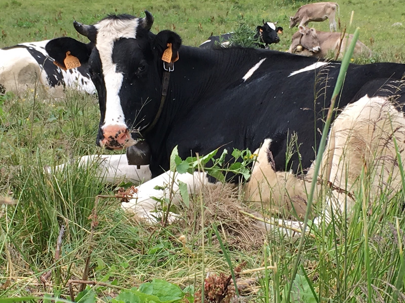
Rather than drive back Kathleen decided that she would walk back to the campsite – as there were no road junctions to navigate I had high hopes of seeing her again without having to organise a search party. Leaving Kathleen to walk I drove back down the narrow steep single track road that lead almost directly to the campsite gate.
Some of the many flowers we saw
Some of the many flowers we saw


No comments:
Post a Comment